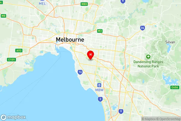
Carnegie Suburbs & Region, Carnegie Map & Postcodes
Carnegie Suburbs & Region, Carnegie Map & Postcodes in Carnegie, Glen Eira, Melbourne Inner South, VIC, AU
Carnegie Region
Region Name
Carnegie (VIC, AU)Carnegie Area
3.8 square kilometers (3.8 ㎢)Postal Codes
3163 (In total, there are 1 postcodes in Carnegie.)Carnegie Introduction
Carnegie is a suburb in Melbourne, Australia, 6 km south-east of Melbourne's central business district (CBD). Its local government area is the City of Monash. At the 2016 Census, Carnegie had a population of 3,001. Carnegie is named after Andrew Carnegie, a Scottish-American businessman and philanthropist. The suburb was developed in the 1880s and 1890s as a residential area for workers in the nearby factories. It is known for its large number of Victorian-era houses and its tree-lined streets. Carnegie has a variety of shops and restaurants, including a supermarket, a pharmacy, and several cafes and restaurants. There are also several parks and recreational facilities, including the Carnegie Reserve, which has a playground, cricket pitch, and basketball court. Carnegie is well-connected to the rest of Melbourne, with several bus routes and train stations nearby. It is also within easy reach of the Monash Freeway and the EastLink freeway, making it a convenient location for commuters.Australia State
City or Big Region
Greater Capital City
Greater Melbourne (2GMEL)District or Regional Area
Suburb Name
Carnegie Region Map

Carnegie Postcodes / Zip Codes
Carnegie Suburbs
Carnegie full address
Carnegie, Glen Eira, Melbourne Inner South, Victoria, VIC, Australia, SaCode: 208021176Country
Carnegie, Glen Eira, Melbourne Inner South, Victoria, VIC, Australia, SaCode: 208021176
Carnegie Suburbs & Region, Carnegie Map & Postcodes has 0 areas or regions above, and there are 1 Carnegie suburbs below. The sa2code for the Carnegie region is 208021176. Its latitude and longitude coordinates are -37.8892,145.057. Carnegie area belongs to Australia's greater capital city Greater Melbourne.
Carnegie Suburbs & Localities
1. Carnegie
