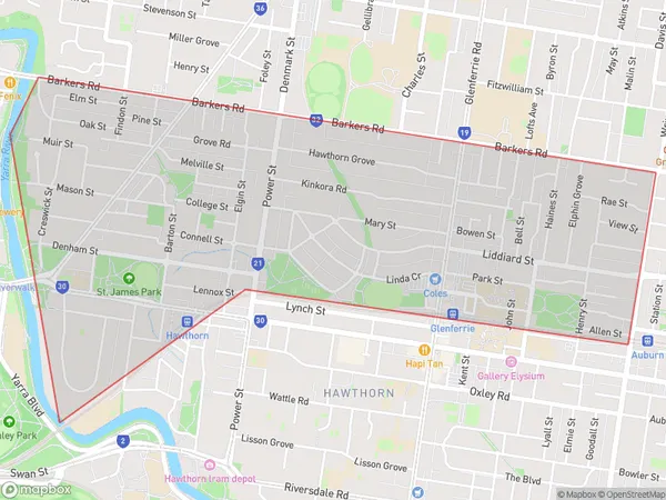
Hawthorn North Suburbs & Region, Hawthorn North Map & Postcodes
Hawthorn North Suburbs & Region, Hawthorn North Map & Postcodes in Hawthorn North, Boroondara, Melbourne Inner East, VIC, AU
Hawthorn North Region
Region Name
Hawthorn North (VIC, AU)Hawthorn North Area
2.46 square kilometers (2.46 ㎢)Hawthorn North Introduction
Hawthorn North is a suburb in Melbourne, Australia, 6 km north-east of Melbourne's central business district (CBD). Its local government area is the City of Boroondara. At the 2016 Census, Hawthorn North had a population of 11,670. Hawthorn North is represented by two members on the City of Boroondara Council, being Sarah Connolly (Labor) and Ken Smith (Liberal). The suburb is named after the hawthorn tree, which is common in the area. The first post office opened in Hawthorn North on 1 July 1889, and was closed on 1 March 1976. Hawthorn North is well-serviced by public transport, with several bus routes and the East Malvern railway station located within the suburb. There are also several parks and recreational facilities, including the Hawthorn Aquatic Centre and the Glenferrie Oval. The suburb is home to a number of prestigious schools, including Ivanhoe Grammar School, Wesley College, and Xavier College. Hawthorn North is also a popular shopping destination, with several shopping strips and malls located along Burwood Road and Glenferrie Road.Australia State
City or Big Region
Greater Capital City
Greater Melbourne (2GMEL)District or Regional Area
Suburb Name
Hawthorn North Suburbs
Hawthorn North full address
Hawthorn North, Boroondara, Melbourne Inner East, Victoria, VIC, Australia, SaCode: 207011519Country
Hawthorn North, Boroondara, Melbourne Inner East, Victoria, VIC, Australia, SaCode: 207011519
Hawthorn North Suburbs & Region, Hawthorn North Map & Postcodes has 0 areas or regions above, and there are 0 Hawthorn North suburbs below. The sa2code for the Hawthorn North region is 207011519. Hawthorn North area belongs to Australia's greater capital city Greater Melbourne.
