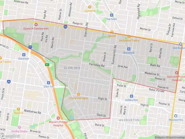
Glen Iris East Suburbs & Region, Glen Iris East Map & Postcodes
Glen Iris East Suburbs & Region, Glen Iris East Map & Postcodes in Glen Iris East, Boroondara, Melbourne Inner East, VIC, AU
Glen Iris East Region
Region Name
Glen Iris East (VIC, AU)Glen Iris East Area
5.7 square kilometers (5.7 ㎢)Glen Iris East Introduction
Glen Iris East is a suburb in Melbourne, Australia, 6 km east of Melbourne's central business district (CBD). It is represented by the Legislative Assembly of Victoria as the Legislative Assembly of Victoria's Electoral district of Ivanhoe. The suburb is named after the Glen Iris Reservoir, which was built in 1868 and is a major water supply for Melbourne. The suburb has a diverse population, with a mix of ethnicities and cultures. It is home to a number of parks and recreational facilities, including the Glen Iris National Park, which is a popular spot for picnics and walks. The suburb also has a number of shopping centers, including the Glen Iris Village Shopping Centre, which has a variety of stores and restaurants. Glen Iris East is well-connected to the rest of Melbourne, with easy access to public transportation. It is also close to a number of major hospitals, including the Royal Melbourne Hospital and the Monash Medical Centre.Australia State
City or Big Region
Greater Capital City
Greater Melbourne (2GMEL)District or Regional Area
Suburb Name
Glen Iris East Suburbs
Glen Iris East full address
Glen Iris East, Boroondara, Melbourne Inner East, Victoria, VIC, Australia, SaCode: 207011150Country
Glen Iris East, Boroondara, Melbourne Inner East, Victoria, VIC, Australia, SaCode: 207011150
Glen Iris East Suburbs & Region, Glen Iris East Map & Postcodes has 0 areas or regions above, and there are 0 Glen Iris East suburbs below. The sa2code for the Glen Iris East region is 207011150. Glen Iris East area belongs to Australia's greater capital city Greater Melbourne.
