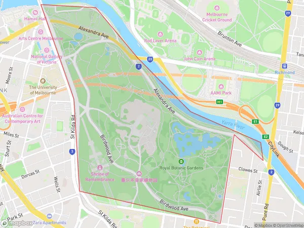
Royal Botanic Gardens Victoria Suburbs & Region, Royal Botanic Gardens Victoria Map & Postcodes
Royal Botanic Gardens Victoria Suburbs & Region, Royal Botanic Gardens Victoria Map & Postcodes in Royal Botanic Gardens Victoria, Melbourne City, Melbourne Inner, VIC, AU
Royal Botanic Gardens Victoria Region
Region Name
Royal Botanic Gardens Victoria (VIC, AU)Royal Botanic Gardens Victoria Area
1.35 square kilometers (1.35 ㎢)Royal Botanic Gardens Victoria Introduction
The Royal Botanic Gardens Victoria is a botanical garden located in Melbourne, Victoria, Australia. It is the oldest botanical garden in Australia and one of the world's oldest, having been established in 1859. The gardens cover an area of 38 hectares and are home to over 8,000 species of plants from around the world. The gardens feature a range of gardens, including the Australian Garden, the Mediterranean Garden, the Chinese Garden, and the Indigenous Garden. The gardens also include a number of buildings, including the Herbarium, which houses a collection of over 2 million specimens of plants, and the Ian Potter Centre, which houses a collection of art and sculptures. The Royal Botanic Gardens Victoria are a popular tourist destination and are open to the public seven days a week.Australia State
City or Big Region
Greater Capital City
Greater Melbourne (2GMEL)District or Regional Area
Suburb Name
Royal Botanic Gardens Victoria Suburbs
Royal Botanic Gardens Victoria full address
Royal Botanic Gardens Victoria, Melbourne City, Melbourne Inner, Victoria, VIC, Australia, SaCode: 206041507Country
Royal Botanic Gardens Victoria, Melbourne City, Melbourne Inner, Victoria, VIC, Australia, SaCode: 206041507
Royal Botanic Gardens Victoria Suburbs & Region, Royal Botanic Gardens Victoria Map & Postcodes has 0 areas or regions above, and there are 0 Royal Botanic Gardens Victoria suburbs below. The sa2code for the Royal Botanic Gardens Victoria region is 206041507. Royal Botanic Gardens Victoria area belongs to Australia's greater capital city Greater Melbourne.
