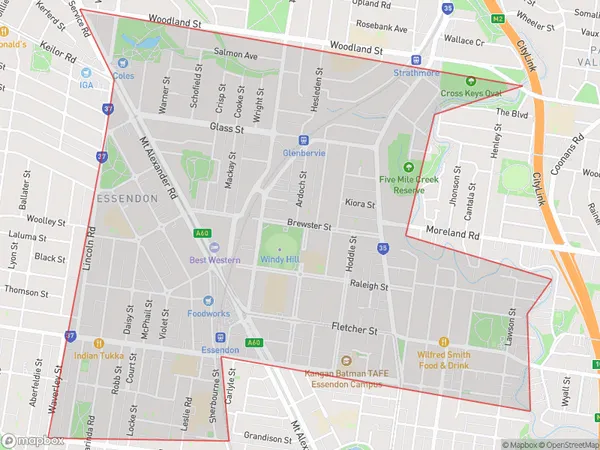
Essendon East Suburbs & Region, Essendon East Map & Postcodes
Essendon East Suburbs & Region, Essendon East Map & Postcodes in Essendon East, Essendon, Melbourne Inner, VIC, AU
Essendon East Region
Region Name
Essendon East (VIC, AU)Essendon East Area
3.55 square kilometers (3.55 ㎢)Essendon East Introduction
Essendon East is a suburb in Melbourne, Victoria, Australia. It is located 6 km north-east of Melbourne's central business district (CBD). The postcode for Essendon East is 3042. The suburb was named after the Essendon Football Club. Essendon East has a variety of shops, cafes, and restaurants, and is home to a number of parks and recreational facilities, including the Essendon Fields Golf Course. The suburb is well-connected to public transport, with the Essendon railway station located on the Craigieburn line.Australia State
City or Big Region
Greater Capital City
Greater Melbourne (2GMEL)District or Regional Area
Suburb Name
Essendon East Suburbs
Essendon East full address
Essendon East, Essendon, Melbourne Inner, Victoria, VIC, Australia, SaCode: 206031502Country
Essendon East, Essendon, Melbourne Inner, Victoria, VIC, Australia, SaCode: 206031502
Essendon East Suburbs & Region, Essendon East Map & Postcodes has 0 areas or regions above, and there are 0 Essendon East suburbs below. The sa2code for the Essendon East region is 206031502. Essendon East area belongs to Australia's greater capital city Greater Melbourne.
