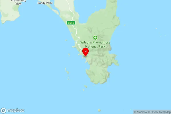
Wilsons Promontory Suburbs & Region, Wilsons Promontory Map & Postcodes
Wilsons Promontory Suburbs & Region, Wilsons Promontory Map & Postcodes in Wilsons Promontory, Gippsland South West, Latrobe Gippsland, VIC, AU
Wilsons Promontory Region
Region Name
Wilsons Promontory (VIC, AU)Wilsons Promontory Area
481.51 square kilometers (481.51 ㎢)Postal Codes
3960 (In total, there are 1 postcodes in Wilsons Promontory.)Wilsons Promontory Introduction
Wilsons Promontory is a mountain located in Victoria, Australia, and is part of the Great Dividing Range. It is the highest point in the state of Victoria and the second-highest point in Australia. The promontory is a popular destination for hikers and nature lovers, with many scenic walks and breathtaking views. It is also home to a variety of wildlife, including kangaroos, wallabies, and echidnas. Wilsons Promontory is a UNESCO World Heritage Site and is considered one of the most significant natural places in Australia.Australia State
City or Big Region
Greater Capital City
Rest of Vic. (2RVIC)District or Regional Area
Suburb Name
Wilsons Promontory Region Map

Wilsons Promontory Postcodes / Zip Codes
Wilsons Promontory Suburbs
Wilsons Promontory full address
Wilsons Promontory, Gippsland South West, Latrobe Gippsland, Victoria, VIC, Australia, SaCode: 205031092Country
Wilsons Promontory, Gippsland South West, Latrobe Gippsland, Victoria, VIC, Australia, SaCode: 205031092
Wilsons Promontory Suburbs & Region, Wilsons Promontory Map & Postcodes has 0 areas or regions above, and there are 2 Wilsons Promontory suburbs below. The sa2code for the Wilsons Promontory region is 205031092. Its latitude and longitude coordinates are -39.0317,146.321. Wilsons Promontory area belongs to Australia's greater capital city Rest of Vic..
Wilsons Promontory Suburbs & Localities
1. Wilsons Promontory
2. Tidal River
