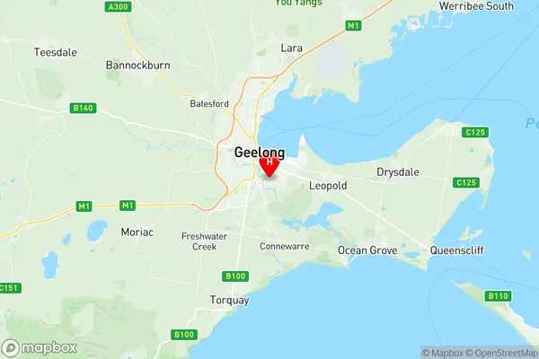
Geelong Suburbs & Region, Geelong Map & Postcodes
Geelong Suburbs & Region, Geelong Map & Postcodes in Geelong, Warrnambool Otway Ranges, Warrnambool and South West, VIC, AU
Geelong Region
Region Name
Geelong (VIC, AU)Geelong Area
12.82 square kilometers (12.82 ㎢)Postal Codes
from 3219 to 3221 (In total, there are 3 postcodes in Geelong.)Geelong Introduction
Geelong, Warrnambool, and South West Victoria are a region in Australia's southwest known for its stunning coastline, vibrant culture, and agricultural industries. Geelong is the region's largest city, home to a bustling port and a vibrant arts and entertainment scene. Warrnambool is famous for its wool industry and stunning natural attractions, including the Great Ocean Road. The region is also home to a number of popular wineries and breweries. South West Victoria is a rural area with a rich history and stunning natural beauty, including the Grampians National Park and the Pyrenees Mountains. The region is known for its produce, including apples, cherries, and wine.Australia State
City or Big Region
Greater Capital City
Rest of Vic. (2RVIC)District or Regional Area
Suburb Name
Geelong Region Map

Geelong Postcodes / Zip Codes
Geelong Suburbs
Geelong full address
Geelong, Warrnambool Otway Ranges, Warrnambool and South West, Victoria, VIC, Australia, SaCode: 203021039Country
Geelong, Warrnambool Otway Ranges, Warrnambool and South West, Victoria, VIC, Australia, SaCode: 203021039
Geelong Suburbs & Region, Geelong Map & Postcodes has 0 areas or regions above, and there are 6 Geelong suburbs below. The sa2code for the Geelong region is 203021039. Its latitude and longitude coordinates are -38.182,144.375. Geelong area belongs to Australia's greater capital city Rest of Vic..
Geelong Suburbs & Localities
1. Breakwater
2. East Geelong
3. Thomson
4. Geelong
5. South Geelong
6. Geelong Mc
