Ballarat Suburbs & Region, Ballarat Map & Postcodes
Ballarat Suburbs & Region, Ballarat Map & Postcodes in Ballarat, Warrnambool Otway Ranges, Warrnambool and South West, VIC, AU
Ballarat Region
Region Name
Ballarat (VIC, AU)Ballarat Area
12.38 square kilometers (12.38 ㎢)Postal Codes
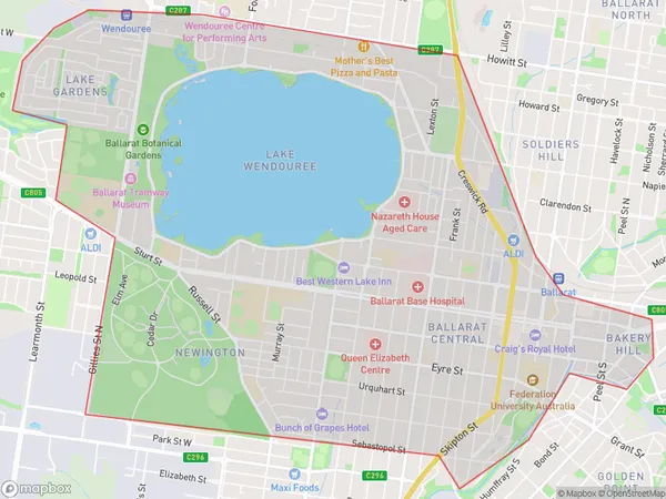
3350, and from 3352 to 3355 (In total, there are 5 postcodes in Ballarat.)Ballarat Suburb Area Map (Polygon)
Ballarat Introduction
Ballarat is a city in central Victoria, Australia, located 115 km north-west of Melbourne. It is known for its rich gold mining history and is home to the iconic Eureka Stockade. The city has a diverse population and is a major cultural and economic hub for the region. It is also home to the Ballarat Botanical Gardens, the Australian National Gallery of Victoria, and the Queen Victoria Museum.Australia State
City or Big Region
Greater Capital City
Rest of Vic. (2RVIC)District or Regional Area
Suburb Name
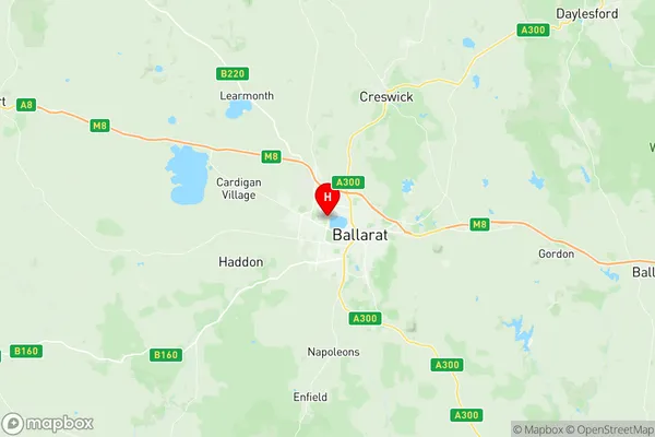
Ballarat Region Map
Ballarat Postcodes / Zip Codes
Ballarat Suburbs
Ballarat full address
Ballarat, Warrnambool Otway Ranges, Warrnambool and South West, Victoria, VIC, Australia, SaCode: 201011002Country
Ballarat, Warrnambool Otway Ranges, Warrnambool and South West, Victoria, VIC, Australia, SaCode: 201011002
Ballarat Suburbs & Region, Ballarat Map & Postcodes has 0 areas or regions above, and there are 11 Ballarat suburbs below. The sa2code for the Ballarat region is 201011002. Its latitude and longitude coordinates are -37.546,143.82. Ballarat area belongs to Australia's greater capital city Rest of Vic..
Ballarat Suburbs & Localities
1. Ballarat West
2. Bakery Hill
3. Ballarat
4. Ballarat Roadside Delivery
5. Ballarat Central
6. Lake Wendouree
7. Newington
8. Ballarat
9. Bakery Hill
10. Ballarat Mc
11. Lake Gardens