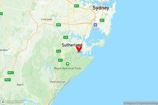
Royal National Park Suburbs & Region, Royal National Park Map & Postcodes
Royal National Park Suburbs & Region, Royal National Park Map & Postcodes in Royal National Park, Shoalhaven, Southern Highlands and Shoalhaven, NSW, AU
Royal National Park Region
Region Name
Royal National Park (NSW, AU)Royal National Park Area
139.33 square kilometers (139.33 ㎢)Postal Codes
1419, 2230, and 2232 (In total, there are 3 postcodes in Royal National Park.)Royal National Park Introduction
The Royal National Park is a national park located in the Southern Highlands and Shoalhaven regions of New South Wales, Australia. It is renowned for its stunning natural beauty, including waterfalls, forests, and beaches. The park is home to a diverse range of wildlife, including kangaroos, wallabies, and koalas. Visitors can enjoy hiking, camping, and fishing in the park. The Royal National Park is also a popular destination for photography, with many scenic spots and breathtaking views.Australia State
City or Big Region
Greater Capital City
Greater Sydney (1GSYD)District or Regional Area
Suburb Name
Royal National Park Region Map

Royal National Park Postcodes / Zip Codes
Royal National Park Suburbs
Royal National Park full address
Royal National Park, Shoalhaven, Southern Highlands and Shoalhaven, New South Wales, NSW, Australia, SaCode: 128021537Country
Royal National Park, Shoalhaven, Southern Highlands and Shoalhaven, New South Wales, NSW, Australia, SaCode: 128021537
Royal National Park Suburbs & Region, Royal National Park Map & Postcodes has 0 areas or regions above, and there are 13 Royal National Park suburbs below. The sa2code for the Royal National Park region is 128021537. Its latitude and longitude coordinates are -34.0641,151.094. Royal National Park area belongs to Australia's greater capital city Greater Sydney.
Royal National Park Suburbs & Localities
1. Southern Suburbs Mc
2. Jibbon
3. Maianbar
4. Palona
5. Warumbul
6. Yenabilli
7. Marley
8. Uloola
9. Audley
10. Bonnie Vale
11. Garie
12. Goarra
13. Wattamolla
