Penrith Suburbs & Region, Penrith Map & Postcodes
Penrith Suburbs & Region, Penrith Map & Postcodes in Penrith, Sydney Outer West and Blue Mountains, NSW, AU
Penrith Region
Region Name
Penrith (NSW, AU)Penrith Area
10.39 square kilometers (10.39 ㎢)Postal Codes
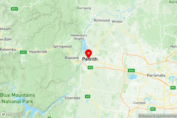
2750, and 2751 (In total, there are 2 postcodes in Penrith.)Penrith Suburb Area Map (Polygon)

Penrith Introduction
Penrith is a large city located in the western suburbs of Sydney, New South Wales, Australia. It is situated in the Cumberland Plain and is part of the Greater Western Sydney region. The city is home to a population of over 500,000 people and is known for its vibrant cultural scene, shopping malls, and recreational facilities. Penrith is also home to the Penrith Panthers, a National Rugby League team that competes in the competition's top tier. The city is surrounded by beautiful natural scenery, including the Blue Mountains and the Nepean River. It is a popular destination for outdoor enthusiasts, with many parks, trails, and gardens to explore.Australia State
City or Big Region
Greater Capital City
Greater Sydney (1GSYD)District or Regional Area
Suburb Name
Penrith Region Map
Penrith Postcodes / Zip Codes
Penrith Suburbs
Penrith full address
Penrith, Sydney Outer West and Blue Mountains, New South Wales, NSW, Australia, SaCode: 124031464Country
Penrith, Sydney Outer West and Blue Mountains, New South Wales, NSW, Australia, SaCode: 124031464
Penrith Suburbs & Region, Penrith Map & Postcodes has 0 areas or regions above, and there are 3 Penrith suburbs below. The sa2code for the Penrith region is 124031464. Its latitude and longitude coordinates are -33.7507,150.688. Penrith area belongs to Australia's greater capital city Greater Sydney.
Penrith Suburbs & Localities
1. Penrith
2. Penrith
3. Penrith Plaza