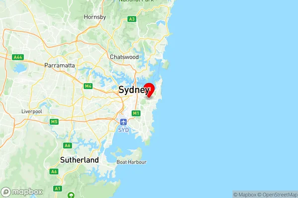
Bondi Junction Waverly Suburbs & Region, Bondi Junction Waverly Map & Postcodes
Bondi Junction Waverly Suburbs & Region, Bondi Junction Waverly Map & Postcodes in Bondi Junction Waverly, Eastern Suburbs North, Sydney Eastern Suburbs, NSW, AU
Bondi Junction Waverly Region
Region Name
Bondi Junction Waverly (NSW, AU)Bondi Junction Waverly Area
2.52 square kilometers (2.52 ㎢)Postal Codes
1355, 2022, and 2024 (In total, there are 3 postcodes in Bondi Junction Waverly.)Bondi Junction Waverly Introduction
Bondi Junction Waverly is a railway station located on the Eastern Suburbs line, serving the Sydney suburb of Bondi Junction. It is served by Sydney Trains T2 Airport line services and NSW TrainLink South Coast line services. The station is located in the Sydney Eastern Suburbs zone and is situated 6.1 kilometers from Sydney Central Station. It is also served by several bus routes, including the 380 and 381. Bondi Junction Waverly was opened on 18 September 1889 as Waverley Station. It was renamed Bondi Junction Waverly in 1924. The station has two platforms, with Platform 1 serving the T2 Airport line and Platform 2 serving the South Coast line. The station is located in a commercial area with several shops and restaurants. It is also a popular tourist destination, with many visitors coming to visit the famous Bondi Beach.Australia State
City or Big Region
Greater Capital City
Greater Sydney (1GSYD)District or Regional Area
Suburb Name
Bondi Junction Waverly Region Map

Bondi Junction Waverly Postcodes / Zip Codes
Bondi Junction Waverly Suburbs
Bondi Junction Waverly full address
Bondi Junction Waverly, Eastern Suburbs North, Sydney Eastern Suburbs, New South Wales, NSW, Australia, SaCode: 118011341Country
Bondi Junction Waverly, Eastern Suburbs North, Sydney Eastern Suburbs, New South Wales, NSW, Australia, SaCode: 118011341
Bondi Junction Waverly Suburbs & Region, Bondi Junction Waverly Map & Postcodes has 0 areas or regions above, and there are 6 Bondi Junction Waverly suburbs below. The sa2code for the Bondi Junction Waverly region is 118011341. Its latitude and longitude coordinates are -33.8914,151.25. Bondi Junction Waverly area belongs to Australia's greater capital city Greater Sydney.
Bondi Junction Waverly Suburbs & Localities
1. Bondi Junction
2. Queens Park
3. Charing Cross
4. Bondi Junction
5. Bondi Junction Plaza
6. Waverley
