Port Kembla Industrial Suburbs & Region, Port Kembla Industrial Map & Postcodes
Port Kembla Industrial Suburbs & Region, Port Kembla Industrial Map & Postcodes in Port Kembla Industrial, Dapto Port Kembla, Illawarra, NSW, AU
Port Kembla Industrial Region
Region Name
Port Kembla Industrial (NSW, AU)Port Kembla Industrial Area
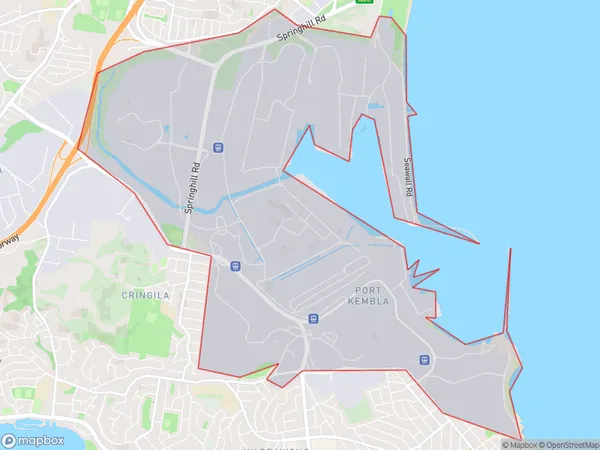
12.94 square kilometers (12.94 ㎢)Postal Codes
2500, and 2505 (In total, there are 2 postcodes in Port Kembla Industrial.)Port Kembla Industrial Suburb Area Map (Polygon)
Port Kembla Industrial Introduction
Port Kembla Industrial is a suburb in the Illawarra region of New South Wales, Australia. It is located approximately 30 kilometers south of Sydney and is home to a major industrial port. The suburb is known for its heavy industry, including steel production, coal mining, and shipbuilding. Port Kembla Industrial has a population of approximately 10,000 people and is a hub for employment and economic activity in the region. It is also home to several schools, parks, and recreational facilities.Australia State
City or Big Region
Greater Capital City
Rest of NSW (1RNSW)District or Regional Area
Suburb Name
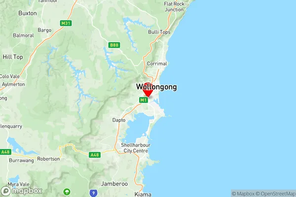
Port Kembla Industrial Region Map
Port Kembla Industrial Postcodes / Zip Codes
Port Kembla Industrial Suburbs
Port Kembla Industrial full address
Port Kembla Industrial, Dapto Port Kembla, Illawarra, New South Wales, NSW, Australia, SaCode: 107011133Country
Port Kembla Industrial, Dapto Port Kembla, Illawarra, New South Wales, NSW, Australia, SaCode: 107011133
Port Kembla Industrial Suburbs & Region, Port Kembla Industrial Map & Postcodes has 0 areas or regions above, and there are 2 Port Kembla Industrial suburbs below. The sa2code for the Port Kembla Industrial region is 107011133. Its latitude and longitude coordinates are -34.4514,150.87. Port Kembla Industrial area belongs to Australia's greater capital city Rest of NSW.
Port Kembla Industrial Suburbs & Localities
1. Port Kembla
2. Spring Hill