Deloraine Suburbs & Region, Deloraine Map & Postcodes
Deloraine Suburbs & Region, Deloraine Map & Postcodes in Deloraine, Devonport, West and North West, TAS, AU
Deloraine Region
Region Name
Deloraine (TAS, AU)Deloraine Area
2521 square kilometers (2,521 ㎢)Postal Codes
7151, 7303, and 7304 (In total, there are 3 postcodes in Deloraine.)Deloraine Suburb Area Map (Polygon)

Deloraine Introduction
Deloraine is a town in the West and North West regions of Tasmania, Australia. It is located in the Meander Valley Council area and is about 25 km west of the state capital, Hobart. The town is known for its beautiful scenery, including the Deloraine Falls and the surrounding mountains. It is also home to a number of historic buildings, including the Deloraine railway station and the Old Deloraine Gaol. The town has a population of around 3,000 people and is a popular tourist destination.Australia State
City or Big Region
Greater Capital City
Rest of Tas. (6RTAS)District or Regional Area
Suburb Name
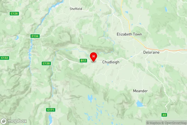
Deloraine Region Map
Deloraine Postcodes / Zip Codes
Deloraine Suburbs
Deloraine full address
Deloraine, Devonport, West and North West, Tasmania, TAS, Australia, SaCode: 602021054Country
Deloraine, Devonport, West and North West, Tasmania, TAS, Australia, SaCode: 602021054
Deloraine Suburbs & Region, Deloraine Map & Postcodes has 0 areas or regions above, and there are 25 Deloraine suburbs below. The sa2code for the Deloraine region is 602021054. Its latitude and longitude coordinates are -41.5586,146.405. Deloraine area belongs to Australia's greater capital city Rest of Tas..
Deloraine Suburbs & Localities
1. Macquarie Island
2. Chudleigh
3. Kimberley
4. Meander
5. Mersey Forest
6. Needles
7. Parkham
8. Caveside
9. Dairy Plains
10. Dunorlan
11. Jackeys Marsh
12. Liena
13. Mayberry
14. Reedy Marsh
15. Exton
16. Deloraine
17. Elizabeth Town
18. Moltema
19. Montana
20. Weegena
21. Mole Creek
22. Red Hills
23. Walls Of Jerusalem
24. Weetah
25. Western Creek