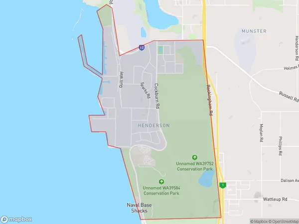
Henderson Suburbs & Region, Henderson Map & Postcodes
Henderson Suburbs & Region, Henderson Map & Postcodes in Henderson, Cockburn, Perth South West, WA, AU
Henderson Region
Region Name
Henderson (WA, AU)Henderson Area
8.74 square kilometers (8.74 ㎢)Henderson Introduction
Henderson is a suburb of Perth, the capital city of Western Australia, and is located in the City of Perth local government area. It is named after Sir John Henderson, who was the Governor of Western Australia from 1868 to 1872. The suburb is located approximately 6 kilometers south-west of Perth's central business district and is bordered by the suburbs of Wembley, Mount Lawley, and Subiaco. Henderson is a well-established suburb with a mix of residential and commercial properties. It has a variety of shops, cafes, and restaurants, as well as a community center and a library. The suburb is also home to several parks and recreational facilities, including the Henderson Park Golf Course and the John Henderson Reserve. Henderson is a popular suburb for families and professionals due to its convenient location, good schools, and abundance of amenities. It is also well-connected to other parts of Perth via public transportation, including the Perth Underground and the bus network.Australia State
City or Big Region
Greater Capital City
Greater Perth (5GPER)District or Regional Area
Suburb Name
Henderson Suburbs
Henderson full address
Henderson, Cockburn, Perth South West, Western Australia, WA, Australia, SaCode: 507011155Country
Henderson, Cockburn, Perth South West, Western Australia, WA, Australia, SaCode: 507011155
Henderson Suburbs & Region, Henderson Map & Postcodes has 0 areas or regions above, and there are 0 Henderson suburbs below. The sa2code for the Henderson region is 507011155. Henderson area belongs to Australia's greater capital city Greater Perth.
