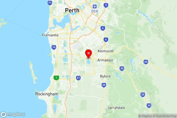
Forrestdale Harrisdale Piara Waters Suburbs & Region, Forrestdale Harrisdale Piara Waters Map & Postcodes
Forrestdale Harrisdale Piara Waters Suburbs & Region, Forrestdale Harrisdale Piara Waters Map & Postcodes in Forrestdale Harrisdale Piara Waters, Gosnells, Perth South East, WA, AU
Forrestdale Harrisdale Piara Waters Region
Region Name
Forrestdale Harrisdale Piara Waters (WA, AU)Postal Codes
6112 (In total, there are 1 postcodes in Forrestdale Harrisdale Piara Waters.)Forrestdale Harrisdale Piara Waters Introduction
Forrestdale Harrisdale Piara Waters is a suburb in the City of Stirling, located in the Perth South East region of Western Australia. It is named after the Harrisdale and Piara Waters rivers, which flow through the area. The suburb is located approximately 16 kilometers southeast of Perth's central business district and is part of the City of Stirling's growth area. The suburb has a variety of housing options, including single-family homes, duplexes, and apartments. It also has a number of recreational facilities, including parks, playgrounds, and sports fields. The suburb is well-connected to public transport, with several bus routes and a train station located within walking distance. The Harrisdale Shopping Centre is the major shopping hub in the suburb, providing a range of retail stores, cafes, and restaurants. The suburb is also home to a number of medical facilities, including a hospital and a medical clinic. In terms of education, Forrestdale Harrisdale Piara Waters is served by a number of primary and secondary schools, including Harrisdale Primary School, Harrisdale Secondary College, and Forrestdale Montessori School. The suburb is also home to a number of tertiary institutions, including the University of Western Australia and Curtin University. Overall, Forrestdale Harrisdale Piara Waters is a well-established and popular suburb with a variety of housing options, recreational facilities, and educational institutions. It is a great place to live and work, with easyAustralia State
City or Big Region
District or Regional Area
Suburb Name
Forrestdale Harrisdale Piara Waters Region Map

Forrestdale Harrisdale Piara Waters Postcodes / Zip Codes
Forrestdale Harrisdale Piara Waters Suburbs
Forrestdale Harrisdale Piara Waters full address
Forrestdale Harrisdale Piara Waters, Gosnells, Perth South East, Western Australia, WA, Australia, SaCode: 506011113Country
Forrestdale Harrisdale Piara Waters, Gosnells, Perth South East, Western Australia, WA, Australia, SaCode: 506011113
Forrestdale Harrisdale Piara Waters Suburbs & Region, Forrestdale Harrisdale Piara Waters Map & Postcodes has 0 areas or regions above, and there are 3 Forrestdale Harrisdale Piara Waters suburbs below. The sa2code for the Forrestdale Harrisdale Piara Waters region is 506011113. Its latitude and longitude coordinates are -32.1478,115.937.
Forrestdale Harrisdale Piara Waters Suburbs & Localities
1. Forrestdale
2. Harrisdale
3. Piara Waters
