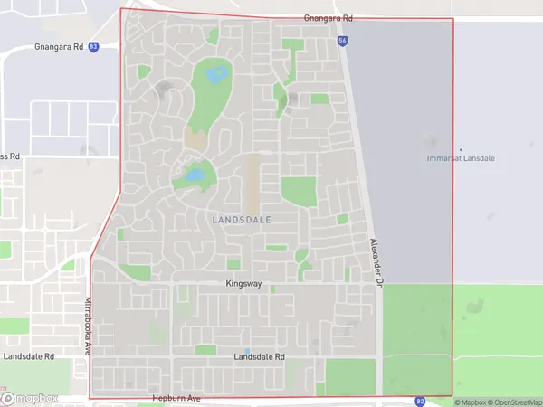
Landsdale Suburbs & Region, Landsdale Map & Postcodes
Landsdale Suburbs & Region, Landsdale Map & Postcodes in Landsdale, Wanneroo, Perth North West, WA, AU
Landsdale Region
Region Name
Landsdale (WA, AU)Landsdale Area
7.23 square kilometers (7.23 ㎢)Landsdale Introduction
Landsdale is a suburb in the City of Perth, Western Australia, located 11 kilometers north-west of Perth's central business district (CBD). It is part of the City of Wanneroo local government area. The suburb was named after the Landsdale Estate, which was established in 1894 by the Landsdale brothers. The estate was named after the Landsdale family's home in England. Landsdale is a primarily residential suburb with a mix of single-family homes, apartments, and townhouses. The suburb has a variety of amenities, including a shopping center, a medical center, a library, and several parks and recreational facilities. The suburb is also home to the Landsdale Golf Club, which is a popular golf course in the region. Landsdale is well-connected to the rest of Perth via the Perth-Mandurah railway line and the Roe Highway. The suburb is also within walking distance of several public transport stations, making it easy for residents to access the CBD and other parts of the city.Australia State
City or Big Region
Greater Capital City
Greater Perth (5GPER)District or Regional Area
Suburb Name
Landsdale Suburbs
Landsdale full address
Landsdale, Wanneroo, Perth North West, Western Australia, WA, Australia, SaCode: 505031304Country
Landsdale, Wanneroo, Perth North West, Western Australia, WA, Australia, SaCode: 505031304
Landsdale Suburbs & Region, Landsdale Map & Postcodes has 0 areas or regions above, and there are 0 Landsdale suburbs below. The sa2code for the Landsdale region is 505031304. Landsdale area belongs to Australia's greater capital city Greater Perth.
