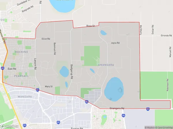
Hocking Pearsall Suburbs & Region, Hocking Pearsall Map & Postcodes
Hocking Pearsall Suburbs & Region, Hocking Pearsall Map & Postcodes in Hocking Pearsall, Wanneroo, Perth North West, WA, AU
Hocking Pearsall Region
Region Name
Hocking Pearsall (WA, AU)Hocking Pearsall Area
26.17 square kilometers (26.17 ㎢)Hocking Pearsall Introduction
Hocking Pearsall is a suburb of Perth, the capital city of Western Australia, located in the northern suburbs approximately 16 kilometers from Perth's central business district (CBD). It is part of the City of Stirling local government area. The suburb was named after John Hocking, who was a landowner in the area in the 1890s. Hocking Pearsall is a relatively new suburb, with most of the development occurring in the 1990s and 2000s. The suburb is characterized by a mix of residential and commercial properties, with several shopping centers, parks, and recreational facilities. It is also home to a number of schools, including Hocking Pearsall Primary School and St. John of God College. The suburb is well-connected to the rest of Perth via public transportation, with several bus routes and the Joondalup railway line passing through it.Australia State
City or Big Region
Greater Capital City
Greater Perth (5GPER)District or Regional Area
Suburb Name
Hocking Pearsall Suburbs
Hocking Pearsall full address
Hocking Pearsall, Wanneroo, Perth North West, Western Australia, WA, Australia, SaCode: 505031303Country
Hocking Pearsall, Wanneroo, Perth North West, Western Australia, WA, Australia, SaCode: 505031303
Hocking Pearsall Suburbs & Region, Hocking Pearsall Map & Postcodes has 0 areas or regions above, and there are 0 Hocking Pearsall suburbs below. The sa2code for the Hocking Pearsall region is 505031303. Hocking Pearsall area belongs to Australia's greater capital city Greater Perth.
