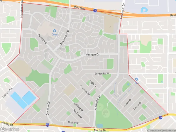
Dianella North Suburbs & Region, Dianella North Map & Postcodes
Dianella North Suburbs & Region, Dianella North Map & Postcodes in Dianella North, Stirling, Perth North West, WA, AU
Dianella North Region
Region Name
Dianella North (WA, AU)Dianella North Area
6.47 square kilometers (6.47 ㎢)Dianella North Introduction
Dianella North is a suburb in the City of Stirling, located 11 kilometers northeast of Perth's central business district (CBD). It is part of the City of Stirling's northern corridor and is bordered by the suburbs of Wembley, Joondalup, Craigie, and Osmington. The suburb was named after the Dianella bush, which is native to the area and is known for its beautiful flowers. Dianella North has a variety of housing options, including single-family homes, apartments, and townhouses. The suburb has a number of parks and recreational facilities, including the Dianella Nature Reserve, which is a popular spot for picnics and walks. The suburb also has a shopping center, a medical center, and a number of schools, including a primary school and a high school.Australia State
City or Big Region
Greater Capital City
Greater Perth (5GPER)District or Regional Area
Suburb Name
Dianella North Suburbs
Dianella North full address
Dianella North, Stirling, Perth North West, Western Australia, WA, Australia, SaCode: 505021301Country
Dianella North, Stirling, Perth North West, Western Australia, WA, Australia, SaCode: 505021301
Dianella North Suburbs & Region, Dianella North Map & Postcodes has 0 areas or regions above, and there are 0 Dianella North suburbs below. The sa2code for the Dianella North region is 505021301. Dianella North area belongs to Australia's greater capital city Greater Perth.
