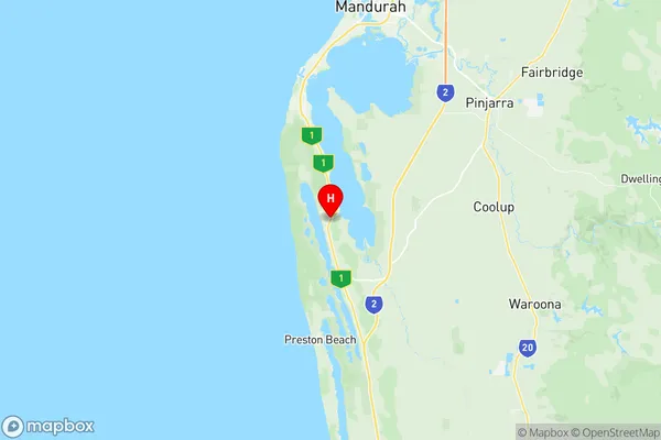
Dawesville Bouvard Suburbs & Region, Dawesville Bouvard Map & Postcodes
Dawesville Bouvard Suburbs & Region, Dawesville Bouvard Map & Postcodes in Dawesville Bouvard, Mandurah, WA, AU
Dawesville Bouvard Region
Region Name
Dawesville Bouvard (WA, AU)Dawesville Bouvard Area
97.92 square kilometers (97.92 ㎢)Postal Codes
6210, and 6211 (In total, there are 2 postcodes in Dawesville Bouvard.)Dawesville Bouvard Introduction
Dawesville Bouvard is a suburb of Mandurah, Western Australia, AU. It is located in the City of Mandurah local government area. The suburb is named after the Dawesville timber mill, which was established in the 1890s. The mill was a major employer in the area and contributed to the development of the suburb. Dawesville Bouvard is a popular residential area with a mix of houses and apartments. It is located close to the beach, with several parks and recreational facilities nearby. The suburb also has a shopping center, a medical center, and a variety of cafes and restaurants.Australia State
City or Big Region
Greater Capital City
Greater Perth (5GPER)District or Regional Area
Suburb Name
Dawesville Bouvard Region Map

Dawesville Bouvard Postcodes / Zip Codes
Dawesville Bouvard Suburbs
Dawesville Bouvard full address
Dawesville Bouvard, Mandurah, Western Australia, WA, Australia, SaCode: 502011021Country
Dawesville Bouvard, Mandurah, Western Australia, WA, Australia, SaCode: 502011021
Dawesville Bouvard Suburbs & Region, Dawesville Bouvard Map & Postcodes has 0 areas or regions above, and there are 8 Dawesville Bouvard suburbs below. The sa2code for the Dawesville Bouvard region is 502011021. Its latitude and longitude coordinates are -32.7549,115.671. Dawesville Bouvard area belongs to Australia's greater capital city Greater Perth.
Dawesville Bouvard Suburbs & Localities
1. Bouvard
2. Clifton
3. Clifton
4. Dawesville
5. Herron
6. Dawesville
7. Herron
8. Bouvard
