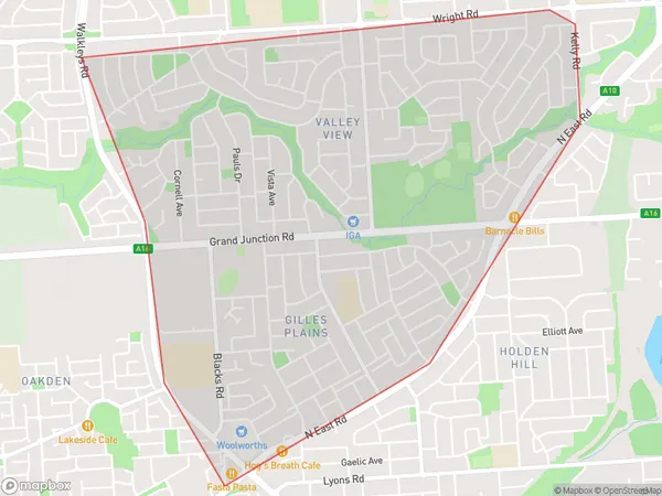
Valley View Gilles Plains Suburbs & Region, Valley View Gilles Plains Map & Postcodes
Valley View Gilles Plains Suburbs & Region, Valley View Gilles Plains Map & Postcodes in Valley View Gilles Plains, Port Adelaide East, Adelaide North, SA, AU
Valley View Gilles Plains Region
Region Name
Valley View Gilles Plains (SA, AU)Valley View Gilles Plains Area
4.68 square kilometers (4.68 ㎢)Valley View Gilles Plains Introduction
Valley View Gilles Plains, Adelaide North, South Australia, AU, is a suburb located 10.7 miles from Adelaide's central business district. It is part of the City of Charles Sturt and has a population of around 1,800 people. The suburb is known for its affordable housing and its proximity to several parks and recreational facilities, including the Gilles Plains Reserve and the North Eastern Sports Park. The area has a mix of residential and commercial properties, with several shopping centers and restaurants located within walking distance. The suburb is well-connected to public transportation, with several bus routes and a train station nearby.Australia State
City or Big Region
Greater Capital City
Greater Adelaide (4GADE)District or Regional Area
Suburb Name
Valley View Gilles Plains Suburbs
Valley View Gilles Plains full address
Valley View Gilles Plains, Port Adelaide East, Adelaide North, South Australia, SA, Australia, SaCode: 402031176Country
Valley View Gilles Plains, Port Adelaide East, Adelaide North, South Australia, SA, Australia, SaCode: 402031176
Valley View Gilles Plains Suburbs & Region, Valley View Gilles Plains Map & Postcodes has 0 areas or regions above, and there are 0 Valley View Gilles Plains suburbs below. The sa2code for the Valley View Gilles Plains region is 402031176. Valley View Gilles Plains area belongs to Australia's greater capital city Greater Adelaide.
