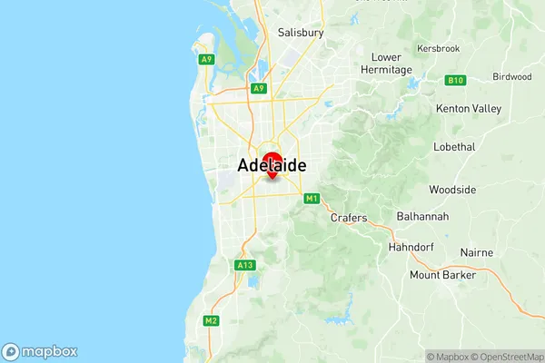
Unley Parkside Suburbs & Region, Unley Parkside Map & Postcodes
Unley Parkside Suburbs & Region, Unley Parkside Map & Postcodes in Unley Parkside, Mitcham, Adelaide South, SA, AU
Unley Parkside Region
Region Name
Unley Parkside (SA, AU)Unley Parkside Area
7.07 square kilometers (7.07 ㎢)Postal Codes
5061, 5063, and 5064 (In total, there are 3 postcodes in Unley Parkside.)Unley Parkside Introduction
Unley Parkside is a suburb of Adelaide, South Australia, located in the City of Norwood Payneham & St Peters. It is bordered by King William Road, Fullarton Road, Goodwood Road, and Marion Road. The suburb is named after the Unley Park, which is a popular recreational area. It is home to a variety of shops, restaurants, and cafes, as well as several parks and reserves. Unley Parkside is a popular location for families and young professionals, with a mix of older and newer homes. It is well-connected to the city center by public transport, and has easy access to the Adelaide Hills and the Southern Ocean.Australia State
City or Big Region
Greater Capital City
Greater Adelaide (4GADE)District or Regional Area
Suburb Name
Unley Parkside Region Map

Unley Parkside Postcodes / Zip Codes
Unley Parkside Suburbs
Unley Parkside full address
Unley Parkside, Mitcham, Adelaide South, South Australia, SA, Australia, SaCode: 401071024Country
Unley Parkside, Mitcham, Adelaide South, South Australia, SA, Australia, SaCode: 401071024
Unley Parkside Suburbs & Region, Unley Parkside Map & Postcodes has 0 areas or regions above, and there are 8 Unley Parkside suburbs below. The sa2code for the Unley Parkside region is 401071024. Its latitude and longitude coordinates are -34.9484,138.601. Unley Parkside area belongs to Australia's greater capital city Greater Adelaide.
Unley Parkside Suburbs & Localities
1. Malvern
2. Unley
3. Highgate
4. Unley Bc
5. Unley Dc
6. Fullarton
7. Parkside
8. Myrtle Bank
