Adelaide Hills Suburbs & Region, Adelaide Hills Map & Postcodes
Adelaide Hills Suburbs & Region, Adelaide Hills Map & Postcodes in Adelaide Hills, Adelaide Central and Hills, SA, AU
Adelaide Hills Region
Region Name
Adelaide Hills (SA, AU)Adelaide Hills Area
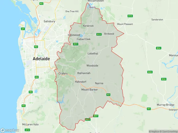
1388 square kilometers (1,388 ㎢)Adelaide Hills Suburb Area Map (Polygon)
Adelaide Hills Introduction
Adelaide Hills is a locality in the City of Prospect in the Australian state of South Australia. It is located 12 km (7 mi) from Adelaide's central business district and is part of the City of Prospect. The suburb is named after the Adelaide Hills, which are located to the north of the suburb. The Adelaide Hills Council was formed in 1997 following the amalgamation of the City of Prospect and the Town of Mount Barker. The council area covers 116.8 km2 (45.4 sq mi) and has a population of approximately 46,000 people. The suburb is home to a number of parks and reserves, including the Mount Lofty Botanic Garden, which is located on the summit of Mount Lofty. The garden is home to a wide range of plants and flowers, including many rare and endangered species. The suburb is also home to a number of wineries and restaurants, which are located in the surrounding hills. The Adelaide Hills is a popular destination for tourists and locals alike, with many people visiting the area to enjoy the natural beauty, the wine, and the food.Australia State
City or Big Region
District or Regional Area
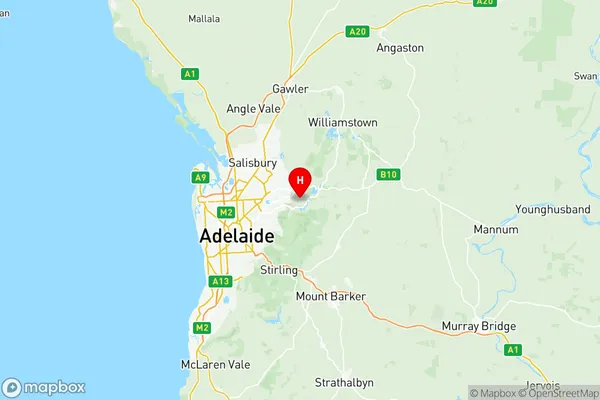
Adelaide Hills Region Map
Adelaide Hills Suburbs
Adelaide Hills full address
Adelaide Hills, Adelaide Central and Hills, South Australia, SA, Australia, SaCode: 40102Country
Adelaide Hills, Adelaide Central and Hills, South Australia, SA, Australia, SaCode: 40102
Adelaide Hills Suburbs & Region, Adelaide Hills Map & Postcodes has 3 areas or regions above, and there are 0 Adelaide Hills suburbs below. The sa3code for the Adelaide Hills region is 40102. Its latitude and longitude coordinates are -34.8473,138.774.