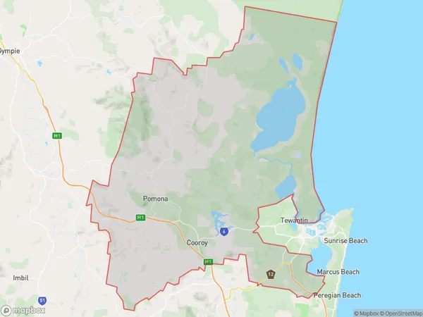
Noosa Hinterland Suburbs & Region, Noosa Hinterland Map & Postcodes
Noosa Hinterland Suburbs & Region, Noosa Hinterland Map & Postcodes in Noosa Hinterland, Sunshine Coast, QLD, AU
Noosa Hinterland Region
Region Name
Noosa Hinterland (QLD, AU)Noosa Hinterland Area
820.07 square kilometers (820.07 ㎢)Noosa Hinterland Introduction
The Noosa Hinterland is a picturesque region located on the Sunshine Coast, Queensland, Australia. It is known for its lush forests, stunning waterfalls, and picturesque villages. The area is home to a diverse range of wildlife, including koalas, wallabies, and kangaroos. The Hinterland is also home to several popular tourist attractions, including the Noosa National Park, the Eumundi Markets, and the Montville Village. Visitors can enjoy hiking, mountain biking, and fishing in the area, as well as exploring the many cafes, restaurants, and boutiques that line the streets of the villages. The Noosa Hinterland is a beautiful and relaxing destination that offers something for everyone.Australia State
City or Big Region
Greater Capital City
Rest of Qld (3RQLD)District or Regional Area
Noosa Hinterland Suburbs
Noosa Hinterland full address
Noosa Hinterland, Sunshine Coast, Queensland, QLD, Australia, SaCode: 31608Country
Noosa Hinterland, Sunshine Coast, Queensland, QLD, Australia, SaCode: 31608
Noosa Hinterland Suburbs & Region, Noosa Hinterland Map & Postcodes has 0 areas or regions above, and there are 0 Noosa Hinterland suburbs below. The sa3code for the Noosa Hinterland region is 31608. Noosa Hinterland area belongs to Australia's greater capital city Rest of Qld.
