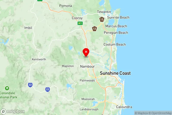
Eumundi Yandina Suburbs & Region, Eumundi Yandina Map & Postcodes
Eumundi Yandina Suburbs & Region, Eumundi Yandina Map & Postcodes in Eumundi Yandina, Nambour Pomona, Sunshine Coast, QLD, AU
Eumundi Yandina Region
Region Name
Eumundi Yandina (QLD, AU)Eumundi Yandina Area
215.79 square kilometers (215.79 ㎢)Postal Codes
from 4560 to 4562 (In total, there are 3 postcodes in Eumundi Yandina.)Eumundi Yandina Introduction
Eumundi Yandina is a locality in the Sunshine Coast Region, Queensland, Australia. It is part of the Kawana Waters district. At the 2011 Australian census, Eumundi Yandina had a population of 1,121. The locality is named after the Yandina River, which flows through it. The river is a tributary of the Maroochy River. Eumundi Yandina is a popular tourist destination, known for its markets, cafes, and restaurants. It is also home to the Eumundi Markets, which are held on the third Saturday of each month. The markets are a popular attraction for locals and tourists alike, with a wide range of products available, including fresh produce, crafts, and souvenirs.Australia State
City or Big Region
Greater Capital City
Rest of Qld (3RQLD)District or Regional Area
Suburb Name
Eumundi Yandina Region Map

Eumundi Yandina Postcodes / Zip Codes
Eumundi Yandina Suburbs
Eumundi Yandina full address
Eumundi Yandina, Nambour Pomona, Sunshine Coast, Queensland, QLD, Australia, SaCode: 316071547Country
Eumundi Yandina, Nambour Pomona, Sunshine Coast, Queensland, QLD, Australia, SaCode: 316071547
Eumundi Yandina Suburbs & Region, Eumundi Yandina Map & Postcodes has 0 areas or regions above, and there are 10 Eumundi Yandina suburbs below. The sa2code for the Eumundi Yandina region is 316071547. Its latitude and longitude coordinates are -26.5875,152.953. Eumundi Yandina area belongs to Australia's greater capital city Rest of Qld.
Eumundi Yandina Suburbs & Localities
1. Valdora
2. Yandina Creek
3. Eerwah Vale
4. Eumundi
5. Kulangoor
6. Bridges
7. Yandina
8. Verrierdale
9. Ninderry
10. North Arm
