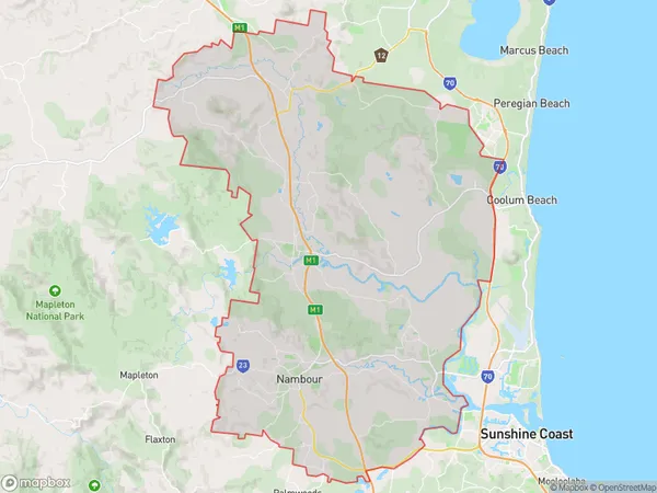
Nambour Suburbs & Region, Nambour Map & Postcodes
Nambour Suburbs & Region, Nambour Map & Postcodes in Nambour, Sunshine Coast, QLD, AU
Nambour Region
Region Name
Nambour (QLD, AU)Nambour Area
345.89 square kilometers (345.89 ㎢)Nambour Introduction
Nambour is a locality in the Sunshine Coast Region, Queensland, Australia. It is part of the Maroochydore Statistical Area. At the 2011 Australian census, Nambour had a population of 9,464. The town is located in the hinterland of the Sunshine Coast and is surrounded by lush forests and mountains. It is known for its agricultural industry, with a number of farms and wineries in the area. The town also has a number of tourist attractions, including the Nambour Showgrounds, which hosts a variety of events throughout the year, and the Sunshine Coast Hinterland Botanical Garden. Nambour is located approximately 90 minutes from Brisbane and 2 hours from the Gold Coast. It is a popular destination for tourists and retirees, with a number of retirement villages and resorts in the area.Australia State
City or Big Region
Greater Capital City
Rest of Qld (3RQLD)District or Regional Area
Nambour Suburbs
Nambour full address
Nambour, Sunshine Coast, Queensland, QLD, Australia, SaCode: 31607Country
Nambour, Sunshine Coast, Queensland, QLD, Australia, SaCode: 31607
Nambour Suburbs & Region, Nambour Map & Postcodes has 0 areas or regions above, and there are 0 Nambour suburbs below. The sa3code for the Nambour region is 31607. Nambour area belongs to Australia's greater capital city Rest of Qld.
