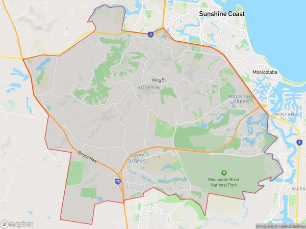
Buderim Suburbs & Region, Buderim Map & Postcodes
Buderim Suburbs & Region, Buderim Map & Postcodes in Buderim, Sunshine Coast, QLD, AU
Buderim Region
Region Name
Buderim (QLD, AU)Buderim Area
76.13 square kilometers (76.13 ㎢)Buderim Introduction
Buderim is a locality in the Sunshine Coast Region, Queensland, Australia. It is part of the Caloundra local government area. Buderim is a hilly suburb with a mountain peak at Mount Buderim. At the 2011 Australian census, Buderim had a population of 4,493. The suburb is named after the Buderim Forest, which is located in the hinterland of the suburb. The forest is home to a variety of native plants and animals, including the rare and endangered Albert's lyrebird. Buderim is a popular tourist destination, with many visitors coming to the area to enjoy the natural beauty of the forest and the beaches on the Sunshine Coast. The suburb is also home to a number of parks and recreational facilities, including the Buderim Forest Park, which is a popular spot for picnics and walks. The suburb is well-connected to the rest of the Sunshine Coast, with easy access to the Bruce Highway and the Sunshine Coast Airport. There are also a number of schools and shopping centres in the area.Australia State
City or Big Region
Greater Capital City
Rest of Qld (3RQLD)District or Regional Area
Buderim Suburbs
Buderim full address
Buderim, Sunshine Coast, Queensland, QLD, Australia, SaCode: 31601Country
Buderim, Sunshine Coast, Queensland, QLD, Australia, SaCode: 31601
Buderim Suburbs & Region, Buderim Map & Postcodes has 0 areas or regions above, and there are 0 Buderim suburbs below. The sa3code for the Buderim region is 31601. Buderim area belongs to Australia's greater capital city Rest of Qld.
