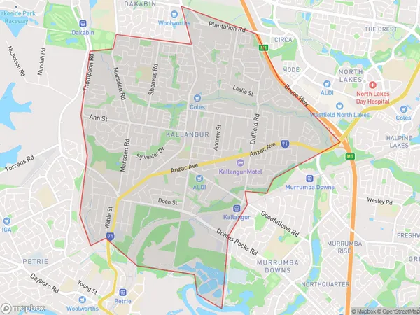
Kallangur Suburbs & Region, Kallangur Map & Postcodes
Kallangur Suburbs & Region, Kallangur Map & Postcodes in Kallangur, North Lakes, Moreton Bay South, QLD, AU
Kallangur Region
Region Name
Kallangur (QLD, AU)Kallangur Area
11.07 square kilometers (11.07 ㎢)Kallangur Introduction
Kallangur is a suburb in the Moreton Bay Region, Queensland, Australia. It is located 13 kilometers north of Brisbane's central business district and is part of the City of Moreton Bay. The suburb has a population of around 21,000 people and is known for its suburban lifestyle and proximity to the beach. Kallangur has a variety of shopping centers, including a large supermarket, a shopping mall, and a variety of specialty stores. The suburb also has a number of parks and recreational facilities, including a sports complex, a golf course, and a number of walking trails.Australia State
City or Big Region
Greater Capital City
Greater Brisbane (3GBRI)District or Regional Area
Suburb Name
Kallangur Suburbs
Kallangur full address
Kallangur, North Lakes, Moreton Bay South, Queensland, QLD, Australia, SaCode: 314021577Country
Kallangur, North Lakes, Moreton Bay South, Queensland, QLD, Australia, SaCode: 314021577
Kallangur Suburbs & Region, Kallangur Map & Postcodes has 0 areas or regions above, and there are 0 Kallangur suburbs below. The sa2code for the Kallangur region is 314021577. Kallangur area belongs to Australia's greater capital city Greater Brisbane.
