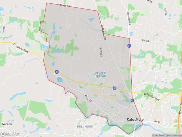
Caboolture West Suburbs & Region, Caboolture West Map & Postcodes
Caboolture West Suburbs & Region, Caboolture West Map & Postcodes in Caboolture West, Caboolture, Moreton Bay North, QLD, AU
Caboolture West Region
Region Name
Caboolture West (QLD, AU)Caboolture West Area
24.59 square kilometers (24.59 ㎢)Caboolture West Introduction
Caboolture West is a locality in the Moreton Bay Region, Queensland, Australia. It is part of the Caboolture Shire local government area. At the 2011 Australian census, Caboolture West had a population of 11,241. Caboolture West is a planned community that was developed in the 1970s and 1980s. It is located approximately 25 kilometers north of Brisbane and is bordered by the Bruce Highway to the north, the Caboolture River to the east, and the Pine River to the south. The locality has a variety of housing options, including single-family homes, townhouses, and apartments. It also has a number of parks and recreational facilities, including a sports complex, a golf course, and a community center. Caboolture West is a popular location for families and retirees due to its peaceful atmosphere, affordable housing, and proximity to amenities. It is also home to a number of businesses and industries, including a major shopping center and a hospital.Australia State
City or Big Region
Greater Capital City
Greater Brisbane (3GBRI)District or Regional Area
Suburb Name
Caboolture West Suburbs
Caboolture West full address
Caboolture West, Caboolture, Moreton Bay North, Queensland, QLD, Australia, SaCode: 313021573Country
Caboolture West, Caboolture, Moreton Bay North, Queensland, QLD, Australia, SaCode: 313021573
Caboolture West Suburbs & Region, Caboolture West Map & Postcodes has 0 areas or regions above, and there are 0 Caboolture West suburbs below. The sa2code for the Caboolture West region is 313021573. Caboolture West area belongs to Australia's greater capital city Greater Brisbane.
