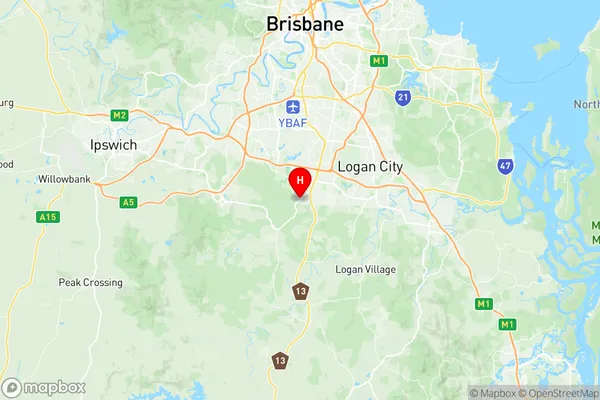
Boronia Heights Park Ridge Suburbs & Region, Boronia Heights Park Ridge Map & Postcodes
Boronia Heights Park Ridge Suburbs & Region, Boronia Heights Park Ridge Map & Postcodes in Boronia Heights Park Ridge, Browns Plains, Logan Beaudesert, QLD, AU
Boronia Heights Park Ridge Region
Region Name
Boronia Heights Park Ridge (QLD, AU)Boronia Heights Park Ridge Area
31.95 square kilometers (31.95 ㎢)Postal Codes
4124, and 4125 (In total, there are 2 postcodes in Boronia Heights Park Ridge.)Boronia Heights Park Ridge Introduction
Boronia Heights Park Ridge is a suburb in the City of Logan, Queensland, Australia. It is located 16 kilometers south of the Brisbane CBD and is part of the Logan City Council. The suburb has a population of around 5,000 people and is known for its large park, which includes a playground, walking tracks, and a picnic area. The park is a popular spot for locals to exercise, relax, and enjoy the outdoors. Boronia Heights Park Ridge also has a shopping center, a medical center, and a number of schools. The suburb is surrounded by other suburbs, including Park Ridge, Mount Warren Park, and Springwood. It is easily accessible to the Gold Coast and the Sunshine Coast, and is just a short drive from the Brisbane Airport.Australia State
City or Big Region
Greater Capital City
Greater Brisbane (3GBRI)District or Regional Area
Suburb Name
Boronia Heights Park Ridge Region Map

Boronia Heights Park Ridge Postcodes / Zip Codes
Boronia Heights Park Ridge Suburbs
Boronia Heights Park Ridge full address
Boronia Heights Park Ridge, Browns Plains, Logan Beaudesert, Queensland, QLD, Australia, SaCode: 311031311Country
Boronia Heights Park Ridge, Browns Plains, Logan Beaudesert, Queensland, QLD, Australia, SaCode: 311031311
Boronia Heights Park Ridge Suburbs & Region, Boronia Heights Park Ridge Map & Postcodes has 0 areas or regions above, and there are 2 Boronia Heights Park Ridge suburbs below. The sa2code for the Boronia Heights Park Ridge region is 311031311. Its latitude and longitude coordinates are -27.6833,153.017. Boronia Heights Park Ridge area belongs to Australia's greater capital city Greater Brisbane.
Boronia Heights Park Ridge Suburbs & Localities
1. Park Ridge
2. Boronia Heights
