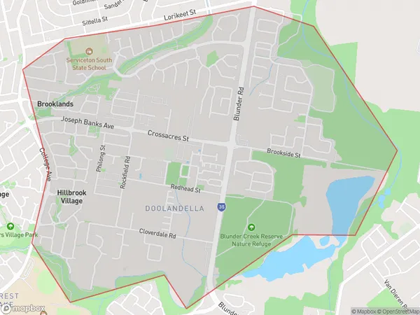
Doolandella Suburbs & Region, Doolandella Map & Postcodes
Doolandella Suburbs & Region, Doolandella Map & Postcodes in Doolandella, Forest Lake Oxley, Ipswich, QLD, AU
Doolandella Region
Region Name
Doolandella (QLD, AU)Doolandella Area
4.03 square kilometers (4.03 ㎢)Doolandella Introduction
Doolandella is a locality in the City of Ipswich, Queensland, Australia. It is located 12 kilometers west of the Ipswich central business district. The suburb has a population of around 1,500 people and is named after the Doolandella Creek that flows through it. The creek provides a water source for the local community and is also home to a variety of wildlife, including fish, birds, and reptiles. Doolandella has a number of parks and recreational facilities, including a cricket club, a tennis court, and a basketball court. The suburb is also home to a number of schools, including Doolandella State School and St Mary's Catholic Primary School.Australia State
City or Big Region
Greater Capital City
Greater Brisbane (3GBRI)District or Regional Area
Suburb Name
Doolandella Suburbs
Doolandella full address
Doolandella, Forest Lake Oxley, Ipswich, Queensland, QLD, Australia, SaCode: 310011563Country
Doolandella, Forest Lake Oxley, Ipswich, Queensland, QLD, Australia, SaCode: 310011563
Doolandella Suburbs & Region, Doolandella Map & Postcodes has 0 areas or regions above, and there are 0 Doolandella suburbs below. The sa2code for the Doolandella region is 310011563. Doolandella area belongs to Australia's greater capital city Greater Brisbane.
