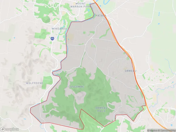
Ormeau (West) Yatala Suburbs & Region, Ormeau (West) Yatala Map & Postcodes
Ormeau (West) Yatala Suburbs & Region, Ormeau (West) Yatala Map & Postcodes in Ormeau (West) Yatala, Ormeau Oxenford, Gold Coast, QLD, AU
Ormeau (West) Yatala Region
Region Name
Ormeau (West) Yatala (QLD, AU)Ormeau (West) Yatala Area
46.55 square kilometers (46.55 ㎢)Ormeau (West) Yatala Introduction
Ormeau (West) Yatala is a locality in the City of Gold Coast, Queensland, Australia. It is located in the southern part of the Gold Coast, about 20 kilometers south of the city center. The suburb is named after the Ormeau River, which flows through it. It is a largely residential area with a mix of single-family homes, apartments, and townhouses. The suburb has a number of parks and recreational facilities, including a golf course, a sports complex, and a community center. It is also home to a number of businesses and industries, including a large shopping center and a manufacturing plant.Australia State
City or Big Region
Greater Capital City
Rest of Qld (3RQLD)District or Regional Area
Suburb Name
Ormeau (West) Yatala Suburbs
Ormeau (West) Yatala full address
Ormeau (West) Yatala, Ormeau Oxenford, Gold Coast, Queensland, QLD, Australia, SaCode: 309071553Country
Ormeau (West) Yatala, Ormeau Oxenford, Gold Coast, Queensland, QLD, Australia, SaCode: 309071553
Ormeau (West) Yatala Suburbs & Region, Ormeau (West) Yatala Map & Postcodes has 0 areas or regions above, and there are 0 Ormeau (West) Yatala suburbs below. The sa2code for the Ormeau (West) Yatala region is 309071553. Ormeau (West) Yatala area belongs to Australia's greater capital city Rest of Qld.
