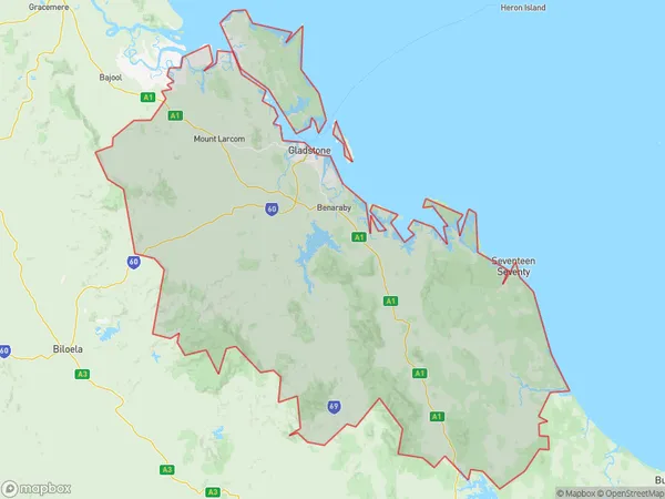
Gladstone Suburbs & Region, Gladstone Map & Postcodes
Gladstone Suburbs & Region, Gladstone Map & Postcodes in Gladstone, Central Queensland, QLD, AU
Gladstone Region
Region Name
Gladstone (QLD, AU)Gladstone Area
10484 square kilometers (10,484 ㎢)Gladstone Introduction
Gladstone is a city in Central Queensland, Australia, on the Coral Sea. It is the fourth-largest city in Queensland and the largest in the Gladstone Region. The city has a population of around 47,000 people and is known for its port, coal mining, and tourism industries. The city is named after British Prime Minister William Ewart Gladstone. The Port of Gladstone is one of the largest coal export ports in the world and is a major contributor to the economy of Central Queensland. The city also has a number of tourist attractions, including the Gladstone Marina, the Gladstone Art Gallery, and the Gladstone Regional Museum.Australia State
City or Big Region
Greater Capital City
Rest of Qld (3RQLD)District or Regional Area
Gladstone Suburbs
Gladstone full address
Gladstone, Central Queensland, Queensland, QLD, Australia, SaCode: 30805Country
Gladstone, Central Queensland, Queensland, QLD, Australia, SaCode: 30805
Gladstone Suburbs & Region, Gladstone Map & Postcodes has 0 areas or regions above, and there are 0 Gladstone suburbs below. The sa3code for the Gladstone region is 30805. Gladstone area belongs to Australia's greater capital city Rest of Qld.
