Tara Suburbs & Region, Tara Map & Postcodes
Tara Suburbs & Region, Tara Map & Postcodes in Tara, Darling Downs (West) Maranoa, Darling Downs Maranoa, QLD, AU
Tara Region
Region Name
Tara (QLD, AU)Tara Area
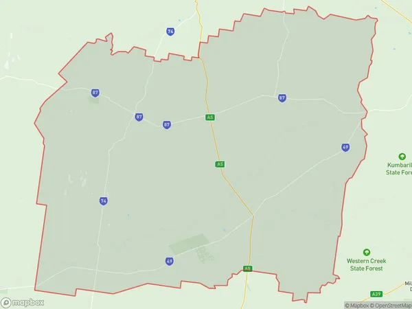
13208 square kilometers (13,208 ㎢)Postal Codes
4405, 4406, 4413, and from 4421 to 4423 (In total, there are 6 postcodes in Tara.)Tara Suburb Area Map (Polygon)
Tara Introduction
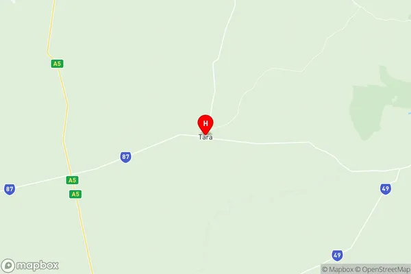
Tara is a locality in the Darling Downs Region, Queensland, Australia. It is one of the major gateways to the Darling Downs from the Queensland coast. The town is located 268 kilometers west of Brisbane, the state capital. Tara is a major agricultural center, with a large number of farms producing cotton, wheat, and other crops. The town has a population of around 2,000 people and is served by a primary school, a post office, a supermarket, and a number of cafes and restaurants. The nearby Mount Superbus National Park is a popular destination for hiking and camping.Australia State
City or Big Region
Greater Capital City
Rest of Qld (3RQLD)District or Regional Area
Suburb Name
Tara Region Map
Tara Postcodes / Zip Codes
Tara Suburbs
Tara full address
Tara, Darling Downs (West) Maranoa, Darling Downs Maranoa, Queensland, QLD, Australia, SaCode: 307011178Country
Tara, Darling Downs (West) Maranoa, Darling Downs Maranoa, Queensland, QLD, Australia, SaCode: 307011178
Tara Suburbs & Region, Tara Map & Postcodes has 0 areas or regions above, and there are 23 Tara suburbs below. The sa2code for the Tara region is 307011178. Its latitude and longitude coordinates are -27.2768,150.457. Tara area belongs to Australia's greater capital city Rest of Qld.
Tara Suburbs & Localities
1. Halliford
2. Hannaford
3. Tara
4. Coomrith
5. Westmar
6. Boondandilla
7. Jimbour East
8. Moonie
9. Southwood
10. The Gums
11. Weir River
12. Flinton
13. Braemar Forest
14. Montrose
15. Wieambilla
16. Goranba
17. Marmadua
18. Weranga
19. Jimbour West
20. Inglestone
21. Meandarra
22. Coomrith
23. Glenmorgan