Auchenflower Suburbs & Region, Auchenflower Map & Postcodes
Auchenflower Suburbs & Region, Auchenflower Map & Postcodes in Auchenflower, Brisbane Inner West, Brisbane Inner City, QLD, AU
Auchenflower Region
Region Name
Auchenflower (QLD, AU)Auchenflower Area
1.27 square kilometers (1.27 ㎢)Postal Codes
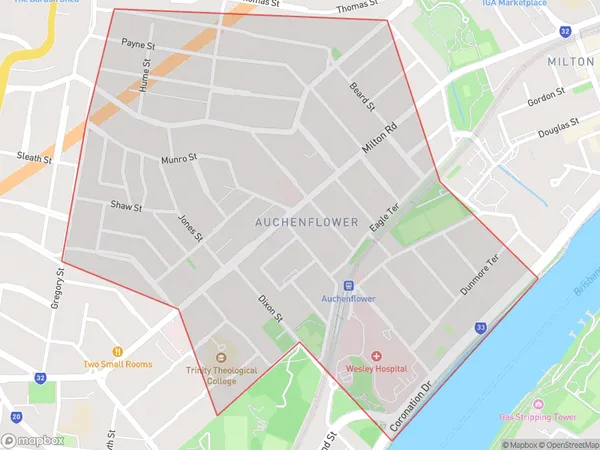
4066 (In total, there are 1 postcodes in Auchenflower.)Auchenflower Suburb Area Map (Polygon)
Auchenflower Introduction
Auchenflower is a suburb in the inner city of Brisbane, Queensland, Australia. It is located 5 kilometers east of the Brisbane CBD and is bordered by the suburbs of Toowong, Paddington, and Milton. Auchenflower is known for its leafy streets, historic homes, and vibrant restaurant and café culture. It is also home to several parks, including Auchenflower Park and the Brisbane Botanic Gardens. The suburb has a diverse population and is popular with young professionals and families. It is well-connected to public transport, with several bus and train lines servicing the area.Australia State
City or Big Region
Greater Capital City
Greater Brisbane (3GBRI)District or Regional Area
Suburb Name
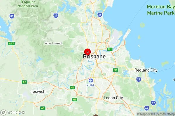
Auchenflower Region Map
Auchenflower Postcodes / Zip Codes
Auchenflower Suburbs
Auchenflower full address
Auchenflower, Brisbane Inner West, Brisbane Inner City, Queensland, QLD, Australia, SaCode: 305041133Country
Auchenflower, Brisbane Inner West, Brisbane Inner City, Queensland, QLD, Australia, SaCode: 305041133
Auchenflower Suburbs & Region, Auchenflower Map & Postcodes has 0 areas or regions above, and there are 2 Auchenflower suburbs below. The sa2code for the Auchenflower region is 305041133. Its latitude and longitude coordinates are -27.4756,152.992. Auchenflower area belongs to Australia's greater capital city Greater Brisbane.
Auchenflower Suburbs & Localities
1. Torwood
2. Auchenflower