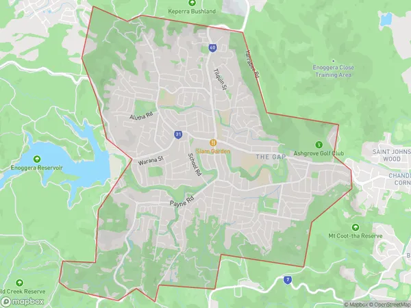
The Gap Suburbs & Region, The Gap Map & Postcodes
The Gap Suburbs & Region, The Gap Map & Postcodes in The Gap, Brisbane Inner West, Brisbane Inner City, QLD, AU
The Gap Region
Region Name
The Gap (QLD, AU)The Gap Area
12.26 square kilometers (12.26 ㎢)Postal Codes
4061 (In total, there are 1 postcodes in The Gap.)The Gap Introduction
The Gap is a suburb in the City of Brisbane, Queensland, Australia. It is located 5 kilometers northwest of the Brisbane CBD and is part of the Brisbane Metropolitan Region. The suburb has a population of around 10,000 people and is known for its peaceful atmosphere, tree-lined streets, and attractive parks. The Gap has a variety of housing options, including apartments, units, and houses, and is popular with families, young professionals, and retirees. The suburb is well-serviced by public transport, with several bus routes and a train station located within walking distance. The Gap also has a variety of shopping centers, including The Gap Village Shopping Centre and The Markets at The Gap. The suburb is surrounded by natural beauty, with the Brisbane River and Mount Coot-tha providing a stunning backdrop. The Gap is a great place to live and work, with its convenient location, peaceful environment, and variety of amenities.Australia State
City or Big Region
Greater Capital City
Greater Brisbane (3GBRI)District or Regional Area
Suburb Name
The Gap Region Map

The Gap Postcodes / Zip Codes
The Gap Suburbs
The Gap full address
The Gap, Brisbane Inner West, Brisbane Inner City, Queensland, QLD, Australia, SaCode: 304041103Country
The Gap, Brisbane Inner West, Brisbane Inner City, Queensland, QLD, Australia, SaCode: 304041103
The Gap Suburbs & Region, The Gap Map & Postcodes has 0 areas or regions above, and there are 1 The Gap suburbs below. The sa2code for the The Gap region is 304041103. Its latitude and longitude coordinates are -27.4402,152.938. The Gap area belongs to Australia's greater capital city Greater Brisbane.
The Gap Suburbs & Localities
1. The Gap
