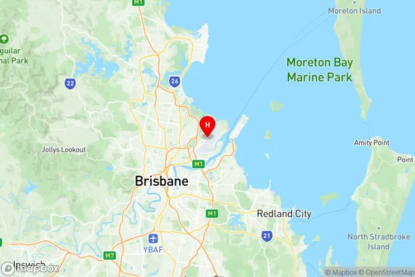
Brisbane Airport Suburbs & Region, Brisbane Airport Map & Postcodes
Brisbane Airport Suburbs & Region, Brisbane Airport Map & Postcodes in Brisbane Airport, Nundah, Brisbane North, QLD, AU
Brisbane Airport Region
Region Name
Brisbane Airport (QLD, AU)Brisbane Airport Area
45.32 square kilometers (45.32 ㎢)Postal Codes
4008 (In total, there are 1 postcodes in Brisbane Airport.)Brisbane Airport Introduction
Brisbane Airport is the primary international and domestic airport serving Brisbane, the capital of Queensland, Australia. It is located approximately 8 kilometers (5 miles) north of the city center. The airport is operated by Brisbane Airport Corporation and handles over 35 million passengers annually. It is home to a wide range of airlines, including Qantas, Virgin Australia, Jetstar, and Emirates. Brisbane Airport offers a comprehensive range of services and facilities to passengers, including baggage handling, retail outlets, food and beverage options, currency exchange, and Wi-Fi connectivity. It is also a major hub for regional and domestic flights, with direct flights to destinations such as Sydney, Melbourne, Auckland, and Hong Kong. The airport has undergone significant expansion in recent years, with a new terminal building and runway completed in 2015. In terms of transportation, Brisbane Airport is well-connected to the city and surrounding areas. There are regular bus services, taxi ranks, and shuttle services available to transport passengers to and from the airport. The airport also has a dedicated train station, the Airport Rail Link, which provides a direct link to the city center and other suburbs. Overall, Brisbane Airport is a vital transportation hub that plays a crucial role in the economic and cultural development of Queensland and the wider region. It is known for its efficient operations, modern facilities, and friendly service, making it a popular choice for travelers from around the world.Australia State
City or Big Region
Greater Capital City
Greater Brisbane (3GBRI)District or Regional Area
Suburb Name
Brisbane Airport Region Map

Brisbane Airport Postcodes / Zip Codes
Brisbane Airport Suburbs
Brisbane Airport full address
Brisbane Airport, Nundah, Brisbane North, Queensland, QLD, Australia, SaCode: 302031036Country
Brisbane Airport, Nundah, Brisbane North, Queensland, QLD, Australia, SaCode: 302031036
Brisbane Airport Suburbs & Region, Brisbane Airport Map & Postcodes has 0 areas or regions above, and there are 4 Brisbane Airport suburbs below. The sa2code for the Brisbane Airport region is 302031036. Its latitude and longitude coordinates are -27.3941,153.115. Brisbane Airport area belongs to Australia's greater capital city Greater Brisbane.
Brisbane Airport Suburbs & Localities
1. Brisbane Airport
2. Pinkenba
3. Bulwer Island
4. Myrtletown
