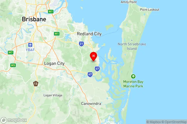
Redland Bay Suburbs & Region, Redland Bay Map & Postcodes
Redland Bay Suburbs & Region, Redland Bay Map & Postcodes in Redland Bay, Cleveland Stradbroke, Brisbane East, QLD, AU
Redland Bay Region
Region Name
Redland Bay (QLD, AU)Redland Bay Area
46.9 square kilometers (46.9 ㎢)Postal Codes
4165 (In total, there are 1 postcodes in Redland Bay.)Redland Bay Introduction
Redland Bay is a suburb in the City of Brisbane, Queensland, Australia. It is located 12 kilometers southeast of the Brisbane CBD and is part of the Redland City Council. The suburb has a population of around 11,000 people and is known for its beautiful beaches, parks, and recreational facilities. It is also home to the Redland Bay Golf Club and the Redland Bay State High School. The area was first settled in the 1860s and was named after the Redland River, which flows through it. The suburb has a rich history and was once home to a number of timber mills and factories. Today, it is a popular residential area with a mix of modern homes and older character properties.Australia State
City or Big Region
Greater Capital City
Greater Brisbane (3GBRI)District or Regional Area
Suburb Name
Redland Bay Region Map

Redland Bay Postcodes / Zip Codes
Redland Bay Suburbs
Redland Bay full address
Redland Bay, Cleveland Stradbroke, Brisbane East, Queensland, QLD, Australia, SaCode: 301021009Country
Redland Bay, Cleveland Stradbroke, Brisbane East, Queensland, QLD, Australia, SaCode: 301021009
Redland Bay Suburbs & Region, Redland Bay Map & Postcodes has 0 areas or regions above, and there are 2 Redland Bay suburbs below. The sa2code for the Redland Bay region is 301021009. Its latitude and longitude coordinates are -27.6372,153.286. Redland Bay area belongs to Australia's greater capital city Greater Brisbane.
Redland Bay Suburbs & Localities
1. Point Talburpin
2. Redland Bay
