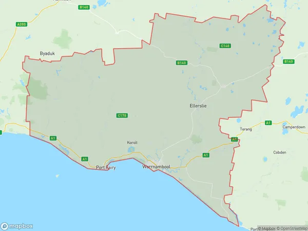
Warrnambool Suburbs & Region, Warrnambool Map & Postcodes
Warrnambool Suburbs & Region, Warrnambool Map & Postcodes in Warrnambool, Warrnambool and South West, VIC, AU
Warrnambool Region
Region Name
Warrnambool (VIC, AU)Warrnambool Area
5496 square kilometers (5,496 ㎢)Warrnambool Introduction
Warrnambool is a city in the southwest of Victoria, Australia. It is the second-largest city in the Western District and the third-largest city in the state of Victoria. The city is located on the Hopkins River and is approximately 325 kilometers southwest of Melbourne. Warrnambool is known for its agriculture, with the region being a major producer of wool, cotton, and dairy products. The city also has a significant manufacturing sector, with a number of factories producing food, beverages, and other products. Warrnambool is home to a number of cultural institutions, including the Warrnambool Art Gallery, the Warrnambool Performing Arts Centre, and the Warrnambool Botanic Gardens. The city is also a popular tourist destination, with many visitors coming to see the city's historic landmarks and attractions, including the Warrnambool Cheese and Wool Museum and the Tower Hill Reserve.Australia State
City or Big Region
Greater Capital City
Rest of Vic. (2RVIC)District or Regional Area
Warrnambool Suburbs
Warrnambool full address
Warrnambool, Warrnambool and South West, Victoria, VIC, Australia, SaCode: 21704Country
Warrnambool, Warrnambool and South West, Victoria, VIC, Australia, SaCode: 21704
Warrnambool Suburbs & Region, Warrnambool Map & Postcodes has 0 areas or regions above, and there are 0 Warrnambool suburbs below. The sa3code for the Warrnambool region is 21704. Warrnambool area belongs to Australia's greater capital city Rest of Vic..
