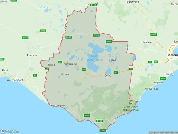
Colac Corangamite Suburbs & Region, Colac Corangamite Map & Postcodes
Colac Corangamite Suburbs & Region, Colac Corangamite Map & Postcodes in Colac Corangamite, Warrnambool and South West, VIC, AU
Colac Corangamite Region
Region Name
Colac Corangamite (VIC, AU)Colac Corangamite Area
7937 square kilometers (7,937 ㎢)Colac Corangamite Introduction
Colac Corangamite, Warrnambool and South West is a federal electoral division in Victoria, Australia. It was created in 1949 and named after the towns of Colac, Corangamite, and Warrnambool. The division covers an area of 10,156 square kilometers and has a population of approximately 330,000 people. It is represented in the Australian House of Representatives by Labor MP Lisa Chesters. Colac Corangamite, Warrnambool and South West is known for its agriculture, with the region being a major producer of wheat, sheep, and dairy products. It is also home to several major wineries and tourism destinations, including the Great Ocean Road and the Twelve Apostles.Australia State
City or Big Region
Greater Capital City
Rest of Vic. (2RVIC)District or Regional Area
Colac Corangamite Suburbs
Colac Corangamite full address
Colac Corangamite, Warrnambool and South West, Victoria, VIC, Australia, SaCode: 21703Country
Colac Corangamite, Warrnambool and South West, Victoria, VIC, Australia, SaCode: 21703
Colac Corangamite Suburbs & Region, Colac Corangamite Map & Postcodes has 0 areas or regions above, and there are 0 Colac Corangamite suburbs below. The sa3code for the Colac Corangamite region is 21703. Colac Corangamite area belongs to Australia's greater capital city Rest of Vic..
