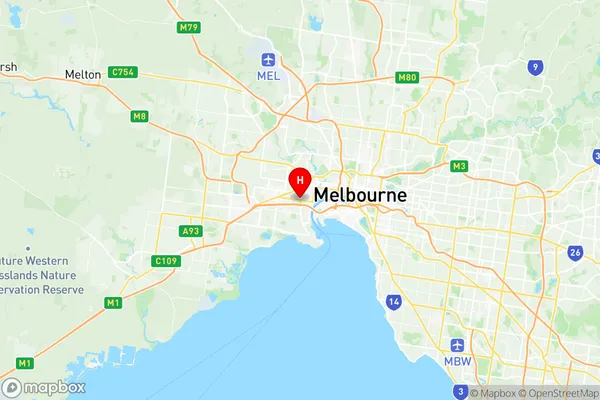
Yarraville Suburbs & Region, Yarraville Map & Postcodes
Yarraville Suburbs & Region, Yarraville Map & Postcodes in Yarraville, Maribyrnong, Melbourne West, VIC, AU
Yarraville Region
Region Name
Yarraville (VIC, AU)Yarraville Area
5.62 square kilometers (5.62 ㎢)Postal Codes
3013 (In total, there are 1 postcodes in Yarraville.)Yarraville Introduction
Yarraville is a suburb in Melbourne, Victoria, Australia, 6 km west of Melbourne's central business district (CBD). It is locally governed by the City of Melbourne and the City of Yarra. Yarraville is represented by two members on the Melbourne City Council: Sophie Wade and Stephen Jolly. The suburb is named after the Yarra River, which flows through it. Yarraville has a rich history and was home to many of Melbourne's early settlers. It was also the site of the first railway station in Victoria, which opened in 1858. Today, Yarraville is a popular suburb with a diverse population. It is known for its vibrant arts scene, with many galleries and museums, as well as its popular restaurants and cafes. The suburb also has a large community garden and a number of parks and recreational facilities.Australia State
City or Big Region
Greater Capital City
Greater Melbourne (2GMEL)District or Regional Area
Suburb Name
Yarraville Region Map

Yarraville Postcodes / Zip Codes
Yarraville Suburbs
Yarraville full address
Yarraville, Maribyrnong, Melbourne West, Victoria, VIC, Australia, SaCode: 213031352Country
Yarraville, Maribyrnong, Melbourne West, Victoria, VIC, Australia, SaCode: 213031352
Yarraville Suburbs & Region, Yarraville Map & Postcodes has 0 areas or regions above, and there are 2 Yarraville suburbs below. The sa2code for the Yarraville region is 213031352. Its latitude and longitude coordinates are -37.8198,144.881. Yarraville area belongs to Australia's greater capital city Greater Melbourne.
Yarraville Suburbs & Localities
1. Yarraville West
2. Yarraville
