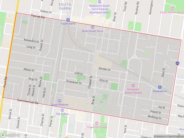
South Yarra South Suburbs & Region, South Yarra South Map & Postcodes
South Yarra South Suburbs & Region, South Yarra South Map & Postcodes in South Yarra South, Stonnington West, Melbourne Inner, VIC, AU
South Yarra South Region
Region Name
South Yarra South (VIC, AU)South Yarra South Area
1.35 square kilometers (1.35 ㎢)South Yarra South Introduction
South Yarra South is a suburb of Melbourne, Victoria, Australia. It is located 3 miles south-east of Melbourne's central business district. The suburb is bounded by Toorak Road to the north, Chapel Street to the east, Commercial Road to the south, and Victoria Street to the west. South Yarra South is known for its vibrant arts and culture scene, with numerous galleries, museums, and theaters. It is also home to a popular shopping district, with many high-end fashion stores and restaurants. The suburb is well-connected to public transportation, with South Yarra railway station and numerous bus routes serving the area.Australia State
City or Big Region
Greater Capital City
Greater Melbourne (2GMEL)District or Regional Area
Suburb Name
South Yarra South Suburbs
South Yarra South full address
South Yarra South, Stonnington West, Melbourne Inner, Victoria, VIC, Australia, SaCode: 206061516Country
South Yarra South, Stonnington West, Melbourne Inner, Victoria, VIC, Australia, SaCode: 206061516
South Yarra South Suburbs & Region, South Yarra South Map & Postcodes has 0 areas or regions above, and there are 0 South Yarra South suburbs below. The sa2code for the South Yarra South region is 206061516. South Yarra South area belongs to Australia's greater capital city Greater Melbourne.
