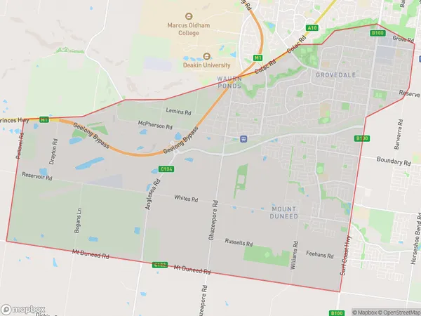
Grovedale Mount Duneed Suburbs & Region, Grovedale Mount Duneed Map & Postcodes
Grovedale Mount Duneed Suburbs & Region, Grovedale Mount Duneed Map & Postcodes in Grovedale Mount Duneed, Geelong, VIC, AU
Grovedale Mount Duneed Region
Region Name
Grovedale Mount Duneed (VIC, AU)Grovedale Mount Duneed Area
37.59 square kilometers (37.59 ㎢)Grovedale Mount Duneed Introduction
Grovedale Mount Duneed is a locality in the City of Greater Geelong, Victoria, Australia. It is located in the western part of the city, approximately 10 kilometers from the central business district. The suburb is named after the Mount Duneed estate, which was once the home of the De La Salle Brothers. The Mount Duneed estate was developed in the 1920s and 1930s and was known for its beautiful gardens and scenic views. Today, Grovedale Mount Duneed is a residential suburb with a mix of houses and apartments. It is known for its peaceful atmosphere, well-maintained parks, and convenient location, with easy access to the beach, shopping centers, and public transport. The suburb also has a community center, a primary school, and a small shopping strip.Australia State
City or Big Region
Greater Capital City
Rest of Vic. (2RVIC)District or Regional Area
Suburb Name
Grovedale Mount Duneed Suburbs
Grovedale Mount Duneed full address
Grovedale Mount Duneed, Geelong, Victoria, VIC, Australia, SaCode: 203021487Country
Grovedale Mount Duneed, Geelong, Victoria, VIC, Australia, SaCode: 203021487
Grovedale Mount Duneed Suburbs & Region, Grovedale Mount Duneed Map & Postcodes has 0 areas or regions above, and there are 0 Grovedale Mount Duneed suburbs below. The sa2code for the Grovedale Mount Duneed region is 203021487. Grovedale Mount Duneed area belongs to Australia's greater capital city Rest of Vic..
