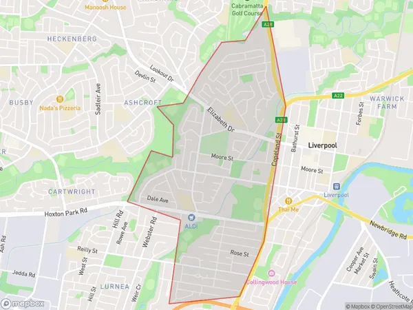
Liverpool West Suburbs & Region, Liverpool West Map & Postcodes
Liverpool West Suburbs & Region, Liverpool West Map & Postcodes in Liverpool West, Liverpool, Sydney South West, NSW, AU
Liverpool West Region
Region Name
Liverpool West (NSW, AU)Liverpool West Area
4.06 square kilometers (4.06 ㎢)Liverpool West Introduction
Liverpool West is a suburb of Sydney, located in the state of New South Wales, Australia. It is situated in the local government area of the City of Liverpool and is part of the South West Sydney region. Liverpool West is known for its vibrant community and diverse population. The suburb has a rich history and is home to several historic buildings and landmarks, including the Liverpool Town Hall and the Liverpool Hospital. It is also home to a number of popular parks and recreational facilities, including Green Valley Park and Liverpool Golf Club. The suburb is well-connected to other parts of Sydney, with easy access to the M5 Motorway and the South West Rail Line. It is also within walking distance of several shopping centers, including Westfield Liverpool and Liverpool Central.Australia State
City or Big Region
Greater Capital City
Greater Sydney (1GSYD)District or Regional Area
Suburb Name
Liverpool West Suburbs
Liverpool West full address
Liverpool West, Liverpool, Sydney South West, New South Wales, NSW, Australia, SaCode: 127031732Country
Liverpool West, Liverpool, Sydney South West, New South Wales, NSW, Australia, SaCode: 127031732
Liverpool West Suburbs & Region, Liverpool West Map & Postcodes has 0 areas or regions above, and there are 0 Liverpool West suburbs below. The sa2code for the Liverpool West region is 127031732. Liverpool West area belongs to Australia's greater capital city Greater Sydney.
