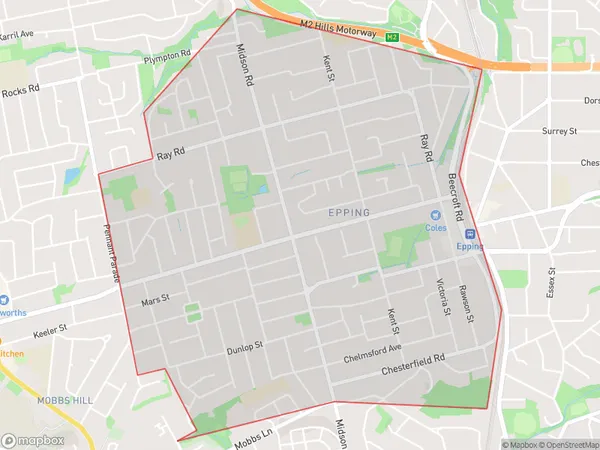
Epping (NSW) West Suburbs & Region, Epping (NSW) West Map & Postcodes
Epping (NSW) West Suburbs & Region, Epping (NSW) West Map & Postcodes in Epping (NSW) West, Pennant Hills Epping, Sydney Ryde, NSW, AU
Epping (NSW) West Region
Region Name
Epping (NSW) West (NSW, AU)Epping (NSW) West Area
4.49 square kilometers (4.49 ㎢)Epping (NSW) West Introduction
Epping (NSW) West is a suburb located in the Macarthur region of Sydney, in New South Wales, Australia. It is situated 26 kilometers west of Sydney's central business district and is part of the Greater Western Sydney region. Epping is known for its large population and diverse cultural heritage. The suburb has a variety of shopping centers, including Epping Plaza and Westfield Epping, as well as several parks and recreational facilities. It is also home to a number of educational institutions, including Epping Boys High School and Epping Girls High School.Australia State
City or Big Region
Greater Capital City
Greater Sydney (1GSYD)District or Regional Area
Suburb Name
Epping (NSW) West Suburbs
Epping (NSW) West full address
Epping (NSW) West, Pennant Hills Epping, Sydney Ryde, New South Wales, NSW, Australia, SaCode: 126011721Country
Epping (NSW) West, Pennant Hills Epping, Sydney Ryde, New South Wales, NSW, Australia, SaCode: 126011721
Epping (NSW) West Suburbs & Region, Epping (NSW) West Map & Postcodes has 0 areas or regions above, and there are 0 Epping (NSW) West suburbs below. The sa2code for the Epping (NSW) West region is 126011721. Epping (NSW) West area belongs to Australia's greater capital city Greater Sydney.
