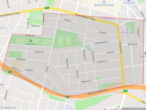
Parramatta South Suburbs & Region, Parramatta South Map & Postcodes
Parramatta South Suburbs & Region, Parramatta South Map & Postcodes in Parramatta South, Parramatta, Sydney Parramatta, NSW, AU
Parramatta South Region
Region Name
Parramatta South (NSW, AU)Parramatta South Area
1.39 square kilometers (1.39 ㎢)Parramatta South Introduction
Parramatta South is a suburb in western Sydney, New South Wales, Australia, 8 kilometers west of Sydney's central business district on the banks of the Parramatta River. It is part of the City of Canada Bay and is represented by the Liberal Party of Australia. The suburb has a diverse population and is known for its multiculturalism, with many residents from different countries and cultures. It is home to a number of major institutions, including the Parramatta Stadium, Westfield Parramatta, and the Parramatta Justice Centre.Australia State
City or Big Region
Greater Capital City
Greater Sydney (1GSYD)District or Regional Area
Suburb Name
Parramatta South Suburbs
Parramatta South full address
Parramatta South, Parramatta, Sydney Parramatta, New South Wales, NSW, Australia, SaCode: 125041718Country
Parramatta South, Parramatta, Sydney Parramatta, New South Wales, NSW, Australia, SaCode: 125041718
Parramatta South Suburbs & Region, Parramatta South Map & Postcodes has 0 areas or regions above, and there are 0 Parramatta South suburbs below. The sa2code for the Parramatta South region is 125041718. Parramatta South area belongs to Australia's greater capital city Greater Sydney.
