Granville Clyde Suburbs & Region, Granville Clyde Map & Postcodes
Granville Clyde Suburbs & Region, Granville Clyde Map & Postcodes in Granville Clyde, Parramatta, Sydney Parramatta, NSW, AU
Granville Clyde Region
Region Name
Granville Clyde (NSW, AU)Granville Clyde Area
5.61 square kilometers (5.61 ㎢)Postal Codes
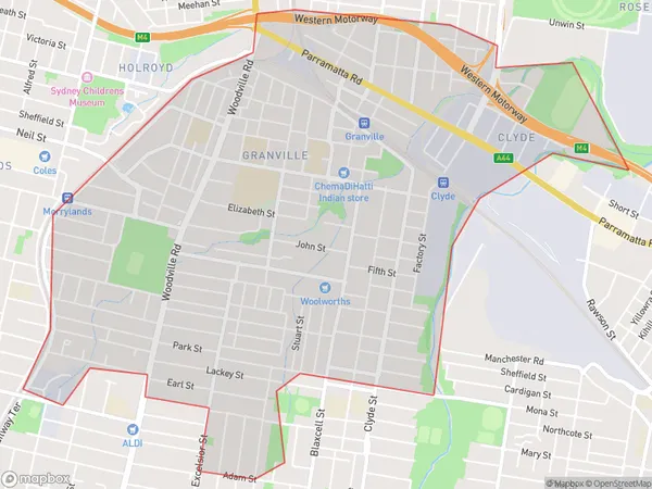
1830, 1831, and 2142 (In total, there are 3 postcodes in Granville Clyde.)Granville Clyde Suburb Area Map (Polygon)
Granville Clyde Introduction
Granville Clyde is a suburb of Sydney, located in the state of New South Wales, Australia. It is situated 20 kilometers west of the Sydney central business district and is part of the Western Sydney region. Granville is known for its large industrial area, which includes the Granville rail yards and the Granville rail station. The suburb also has a significant population of migrant workers and students, drawn to its affordable housing and proximity to Sydney. Granville Clyde has a number of parks and recreational facilities, including the Granville Showground and the Granville rail sportsground. The area is also home to a number of cultural institutions, including the Granville Town Hall and the Granville Public Library.Australia State
City or Big Region
Greater Capital City
Greater Sydney (1GSYD)District or Regional Area
Suburb Name
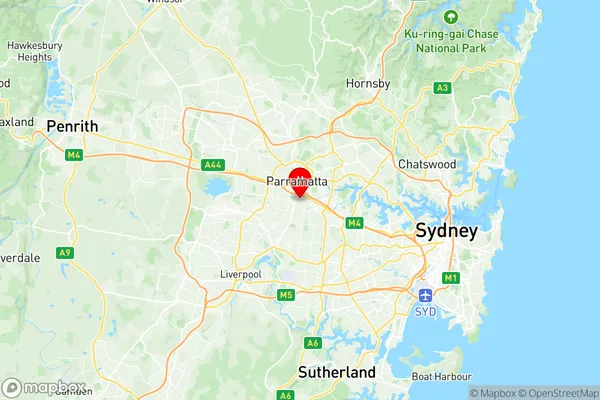
Granville Clyde Region Map
Granville Clyde Postcodes / Zip Codes
Granville Clyde Suburbs
Granville Clyde full address
Granville Clyde, Parramatta, Sydney Parramatta, New South Wales, NSW, Australia, SaCode: 125031481Country
Granville Clyde, Parramatta, Sydney Parramatta, New South Wales, NSW, Australia, SaCode: 125031481
Granville Clyde Suburbs & Region, Granville Clyde Map & Postcodes has 0 areas or regions above, and there are 4 Granville Clyde suburbs below. The sa2code for the Granville Clyde region is 125031481. Its latitude and longitude coordinates are -33.8353,151.007. Granville Clyde area belongs to Australia's greater capital city Greater Sydney.
Granville Clyde Suburbs & Localities
1. Granville
2. Granville
3. Granville
4. Clyde