Camden Ellis Lane Suburbs & Region, Camden Ellis Lane Map & Postcodes
Camden Ellis Lane Suburbs & Region, Camden Ellis Lane Map & Postcodes in Camden Ellis Lane, Bringelly Green Valley, Sydney South West, NSW, AU
Camden Ellis Lane Region
Region Name
Camden Ellis Lane (NSW, AU)Camden Ellis Lane Area
26.19 square kilometers (26.19 ㎢)Postal Codes
2570 (In total, there are 1 postcodes in Camden Ellis Lane.)Camden Ellis Lane Introduction
Camden Ellis Lane is a suburb located in the South West of Sydney, in the state of New South Wales, Australia. It is situated in the local government area of the City of Campbelltown and is part of the Macarthur region. Camden Ellis Lane is named after the former Prime Minister of Australia, Sir Camden Ellis. The suburb is primarily residential and is known for its quiet and peaceful atmosphere. It is surrounded by parks and recreational facilities, including Camden Park, which features a cricket oval, tennis courts, and a playground. The suburb is also home to several schools, including Camden High School and Camden Public School. Camden Ellis Lane is well-connected to the rest of Sydney, with easy access to the M4 motorway and the South West Rail Line. It is also a short drive from the city center of Sydney, which is approximately 20 miles away.Australia State
City or Big Region
Greater Capital City
Greater Sydney (1GSYD)District or Regional Area
Suburb Name
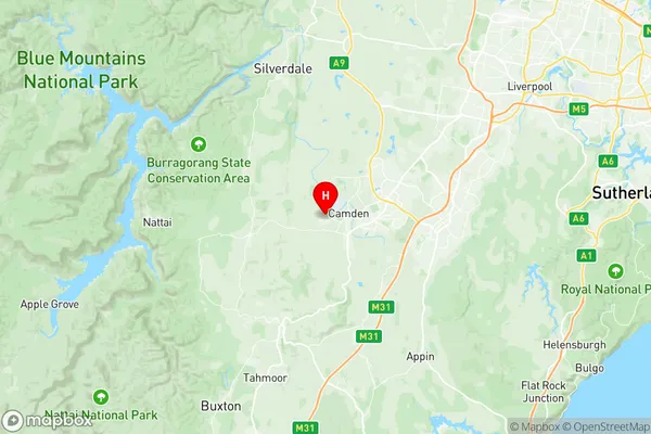
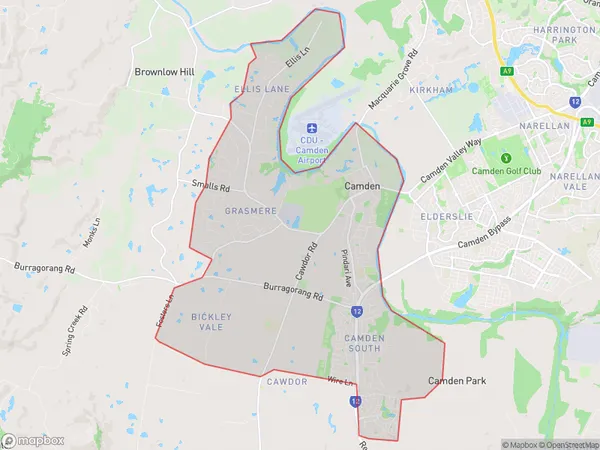
Camden Ellis Lane Region Map

Camden Ellis Lane Postcodes / Zip Codes
Camden Ellis Lane Suburbs
Camden Ellis Lane full address
Camden Ellis Lane, Bringelly Green Valley, Sydney South West, New South Wales, NSW, Australia, SaCode: 123011433Country
Camden Ellis Lane, Bringelly Green Valley, Sydney South West, New South Wales, NSW, Australia, SaCode: 123011433
Camden Ellis Lane Suburbs & Region, Camden Ellis Lane Map & Postcodes has 0 areas or regions above, and there are 7 Camden Ellis Lane suburbs below. The sa2code for the Camden Ellis Lane region is 123011433. Its latitude and longitude coordinates are -34.057,150.667. Camden Ellis Lane area belongs to Australia's greater capital city Greater Sydney.
Camden Ellis Lane Suburbs & Localities
1. Grasmere
2. Bickley Vale
3. Camden
4. Camden Park
5. Camden South
6. Cawdor
7. Ellis Lane
