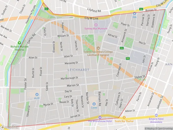
Leichhardt Suburbs & Region, Leichhardt Map & Postcodes
Leichhardt Suburbs & Region, Leichhardt Map & Postcodes in Leichhardt, Sydney Inner West, NSW, AU
Leichhardt Region
Region Name
Leichhardt (NSW, AU)Leichhardt Area
2.98 square kilometers (2.98 ㎢)Leichhardt Introduction
Leichhardt is a suburb of Sydney, in the state of New South Wales, Australia. It is located 5 kilometers southwest of the Sydney central business district and is part of the Inner West Council. Leichhardt is known for its vibrant cultural scene, with a large number of artists, musicians, and writers living in the area. The suburb has a rich history, with many historic buildings and landmarks, including the Leichhardt Town Hall, the Leichhardt Library, and the Leichhardt Cemetery. Leichhardt is also home to a number of popular parks and recreational facilities, including the Leichhardt Oval, the Leichhardt Park Aquatic Centre, and the Leichhardt Community Centre.Australia State
City or Big Region
Greater Capital City
Greater Sydney (1GSYD)District or Regional Area
Suburb Name
Leichhardt Suburbs
Leichhardt full address
Leichhardt, Sydney Inner West, New South Wales, NSW, Australia, SaCode: 120021675Country
Leichhardt, Sydney Inner West, New South Wales, NSW, Australia, SaCode: 120021675
Leichhardt Suburbs & Region, Leichhardt Map & Postcodes has 0 areas or regions above, and there are 0 Leichhardt suburbs below. The sa2code for the Leichhardt region is 120021675. Leichhardt area belongs to Australia's greater capital city Greater Sydney.
