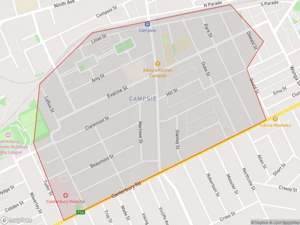
Campsie South Suburbs & Region, Campsie South Map & Postcodes
Campsie South Suburbs & Region, Campsie South Map & Postcodes in Campsie South, Canterbury, Sydney Inner South West, NSW, AU
Campsie South Region
Region Name
Campsie South (NSW, AU)Campsie South Area
1.12 square kilometers (1.12 ㎢)Campsie South Introduction
Campsie South is a suburb in Sydney, New South Wales, Australia. It is located 12 kilometers south-west of the Sydney central business district and is part of the City of Canada Bay. The suburb is named after the Campsie railway station, which was located on the Main Suburban line. Campsie South is a diverse suburb with a mix of residential, commercial, and industrial areas. The population is estimated to be around 11,000 people, with a majority of residents being of Asian descent. The suburb has a number of parks and recreational facilities, including the Campsie Sports Complex and the John Edmondson Reserve. The area is well-connected to the rest of Sydney, with buses and trains providing easy access to the city. The Sydney Airport is also located within a short drive.Australia State
City or Big Region
Greater Capital City
Greater Sydney (1GSYD)District or Regional Area
Suburb Name
Campsie South Suburbs
Campsie South full address
Campsie South, Canterbury, Sydney Inner South West, New South Wales, NSW, Australia, SaCode: 119021660Country
Campsie South, Canterbury, Sydney Inner South West, New South Wales, NSW, Australia, SaCode: 119021660
Campsie South Suburbs & Region, Campsie South Map & Postcodes has 0 areas or regions above, and there are 0 Campsie South suburbs below. The sa2code for the Campsie South region is 119021660. Campsie South area belongs to Australia's greater capital city Greater Sydney.
