Wagga Wagga Region Suburbs & Region, Wagga Wagga Region Map & Postcodes
Wagga Wagga Region Suburbs & Region, Wagga Wagga Region Map & Postcodes in Wagga Wagga Region, Wagga Wagga, Riverina, NSW, AU
Wagga Wagga Region Region
Region Name
Wagga Wagga Region (NSW, AU)Wagga Wagga Region Area
9335 square kilometers (9,335 ㎢)Postal Codes
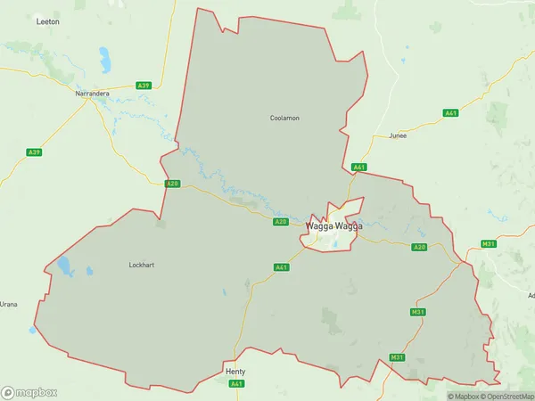
2642, 2645, from 2650 to 2652, 2655, 2656, 2658, 2663, 2701, and 2702 (In total, there are 11 postcodes in Wagga Wagga Region.)Wagga Wagga Region Suburb Area Map (Polygon)
Wagga Wagga Region Introduction
Wagga Wagga Region is a region located in the Riverina and Central West areas of New South Wales, Australia. It is known for its rich agricultural industry, including cotton farming, and is home to the city of Wagga Wagga. The region has a population of over 400,000 people and is located approximately 550 miles southwest of Sydney. Wagga Wagga is the administrative center of the region and is home to several major landmarks, including the Wagga Wagga Showground and the Wagga Wagga Botanic Gardens. The region is also home to a number of universities and colleges, including Charles Sturt University and the University of New England.Australia State
City or Big Region
Greater Capital City
Rest of NSW (1RNSW)District or Regional Area
Suburb Name
Wagga Wagga Region Region Map
Wagga Wagga Region Postcodes / Zip Codes
Wagga Wagga Region Suburbs
Wagga Wagga Region full address
Wagga Wagga Region, Wagga Wagga, Riverina, New South Wales, NSW, Australia, SaCode: 113031271Country
Wagga Wagga Region, Wagga Wagga, Riverina, New South Wales, NSW, Australia, SaCode: 113031271
Wagga Wagga Region Suburbs & Region, Wagga Wagga Region Map & Postcodes has 0 areas or regions above, and there are 77 Wagga Wagga Region suburbs below. The sa2code for the Wagga Wagga Region region is 113031271. Its latitude and longitude coordinates are -35.0886,147.129. Wagga Wagga Region area belongs to Australia's greater capital city Rest of NSW.
Wagga Wagga Region Suburbs & Localities
1. Yerong Creek
2. Cullivel
3. Alfredtown
4. Belfrayden
5. Borambola
6. Burrandana
7. Coursing Park
8. Dhulura
9. Downside
10. Yuluma
11. Book Book
12. Currawarna
13. Eunanoreenya
14. Gregadoo
15. Pulletop
16. Rowan
17. Yathella
18. Forest Hill
19. Humula
20. Uranquinty
21. Tootool
22. Osborne
23. Pleasant Hills
24. Methul
25. Gelston Park
26. Galore
27. Mangoplah
28. Tarcutta
29. French Park
30. Brookdale
31. Urangeline East
32. Cowabbie
33. Rannock
34. Bidgeemia
35. Wrathall
36. Berry Jerry
37. Big Springs
38. Bulgary
39. Currawananna
40. Eunonoreenya
41. Galore
42. Harefield
43. Oberne Creek
44. Brucedale
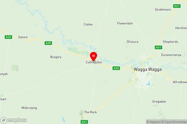
45. Collingullie
46. Euberta
47. Gobbagombalin
48. Hillgrove
49. Kyeamba
50. Maxwell
51. Wallacetown
52. Westby
53. Yarragundry
54. Cowabbie
55. Ladysmith
56. Murrulebale
57. Kubura
58. Brookong
59. Fargunyah
60. Milbrulong
61. Grubben
62. Berry Jerry
63. Oura
64. The Gap
65. Wagga Wagga Raaf
66. Marrar
67. Matong
68. Oberne
69. Birdlip
70. The Rock
71. Lockhart
72. Urangeline
73. Munyabla
74. Ryan
75. Coolamon
76. Tooyal
77. Ganmain